A runners perspective


I hope this blog is of use/interest to walkers, runners and cyclists living in or intending to visit Scotland. Most of my entries below are described as long-distance runs - just because that's currently what I enjoy doing...
Showing posts with label southern uplands. Show all posts

Monday, 26 May 2014

Edinburgh to England

Distance: 67 miles (108km) Ascent/Descent: 1380m/1360m  
Start/Finish: Edinburgh - Berwick upon Tweed 
Terrain: First 35miles flat and easy, bikepath/established trail, then it gets bumpy. Short sections of thick vegetation (R. Tyne)   
Transport: train stations at start/end.  Perrymans Buses link Eyemouth, Cockburnspath, Dunbar, Berwick, Edinburgh  
Route: Map Part 1 Map Part 2

Summary
  
A long day, but a fun project to find a route with interest between Edinburgh and England.  Nice rural and coastal bits with hills, but unlike me you should be able to enjoy a prevailing tailwind.  Unless as I suspect global warming has "broken" this!  If you want to break the 70mile barrier, start in central Edinburgh and follow the bikepath around Holyrood Park into Brunstane, part of the John Muir Way and clear on the OS map.

Blog


Brunstane Path - from Brunstane Station
Thanks to Sharon I was setting of from Brunstane Station on the East edge of Edinburgh at 6am - it was an early start just to ensure there'd be enough time for food and drinks in Berwick this evening - possibly the best tasting food and drinks ever!  The sky was a dirty grey and there was drizzle in the air, but it was also mild and calm and I'd had enough coffee so wasn't grumbling.  I felt pretty fit and confident that I'd enjoy most the journey - especially as it was all new trails to me, excluding a few miles along the Edinburgh Marathon route at the start.

Down the recently-surfaced Brunstane Burn Path towards the coast and into Musselburgh, thank God for the garage there as the public loos were locked at this early hour and I was in pain.  Which chocolate bars to buy for the right to use the facilities is probably the quickest decision I'll ever make.

I continued much more comfortably following arrows and signs and police cones prepared for the Edinburgh Marathon tomorrow (I never got my entry in this year - possibly over-compensating for that today!) then cut off along the John Muir Way which heads East between the wierd landscape of Ash Lagoons and Musselburgh Race Course, through Portobello and around the decommissioned coal power station,  Those chimneys are coming down as the facility get refitted with gas-turbines!  This was the first of two concrete walkways around powerstations that featured on today's route. There were some nice bits too I promise!


Re-joining the marathon route, which gets much nicer as it leaves Cockenzie behind and parallels Seton Rocks/Sands, I followed a path along a quiet winding road through hawthorns, about the 15 and 21 mile points of the race. I turned right up a lane by the Golf Course and then into Longniddry Dean, then out onto the road at the top and along pavement for a mile to Longniddry Station where Sharon was waiting patiently with some replacement water for the bottles. 

About 10 very easy miles done, fairly urban, was looking forward to getting into the countryside a bit more...

Looking back along Longniddry - Haddington Railway Bike Path
I entered Longniddry station and crossed the tracks via the footbridge, picking up the railway bikepath on the other side which would swing off SE towards Haddington.  This was more like it!  Again very easy running being an old railway path, it climbed gently through hawthorns with views back NW over wheat fields, as far as Fife's Lomond Hills across the Firth of Forth.  I followed the bike-route signs under the A1 and eventually down through town along West Road with its large houses, through the square and onto the bridge over the Scottish River Tyne, where Sharon was parked with some salt n vinegar crisps ready!  The idea was that next time I'd see her, she'd be warmed-up and ready to run after enjoying a nice lunch in a warm deli/cafe in Cockburnspath that didn't actually exist and was a figment of my badly eroded memory from being there to start running the Southern Upland Way over 3 years ago!  Oops.
 
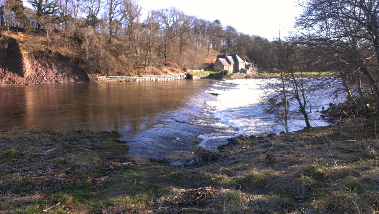
Abbey Bridge over River Tyne
River Tyne
From Haddington, I'd pretty much be following the River Tyne to the coast near Dunbar, thanks to a right-of-way called the "River Tyne Walkway".  To get onto this, I had to continue East after the bridge until reaching a park after a cemetry on the left, where I turned left down a lane to a bridge back over the river again, then sharply right to pick up an excellent bikepath for about 1.5 miles.
 

The bikepath finishes at Abbey Bridge, from where a much more rustic riverside path continues via a style beneath one of the bridge's arches.  At this time of year (late Spring) the route was already fairly overgrown in patches, so my pace slowed accordingly, and I was glad to be wearing calf-guards as there were a few nettles hiding in there!  Otherwise it was fine to run, with care, I'm not sure what it would be like in July/August, or if it gets any maintenance.

The river is quite modest, the scene was very rural now, if you ignored the A1 a couple of fields away, and it all felt very English already!  Literally through the hamlet of Sandy's Mill, ncluding across someone's garden via gates with signs that ask you to respect the owner's privacy, i.e., don't loiter.  Then past Hailes Castle and back under the A1 into the tidy town of East Linton.  

Hailes Castle across the River Tyne
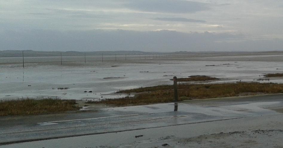
Mouth of the Scottish River Tyne
Bellhaven Bay
After consulting a map at what felt like the centre of the village, I followed the High Street then turned Right onto Preston Road joining the John Muir Way for the second time today.  A JMW sign pointed me off this back to the River Tyne and a footbridge across it.  From here the good signposting of the JMW took me down towards and then onto an Embankment, which to my surprise turned out to be part of the East Coast of Scotland!  On its other side was the estuarine mouth of the Tyne.  The JMW took a lumpy route along the S shore of the estuary before swinging away more E through trees and back out towards Belhaven.  In spite of the wind which was wearing me a bit, I tried to stay true to the JMW along the outside of the golf course, but erosion blocked the route past the Club House so I was forced S onto "Back Road" into Dunbar.  No great loss, I'm not that keen on flying golf balls as they can make holes-in-one. (Sorry).


It was almost sunny in Dunbar, and it was busy.  Maybe too busy for a thirsty runner who'd run 30 miles.  I grabbed myself a couple bottles of powerade and got on my way, again needing my map to find the path out of town onto the coast - just so easy to just keep following the road instead especially when a bit tired.


Leaving Dunbar, about to brave more golf balls
Barns Ness
Thus followed some more golf-ball dodging, hemmed between a 2ft cliff to the beach and the out-of-bounds markers, with occasional signs reminding you that you were entering the flight path of golf balls. Joy. 

I sped up and kept my head low, glad when the fairways were behind and I turned a coastal corner away from that wind for half a mile.  Only to re-enter more golf-ball avoidance territory and then a large opencast lime quarry.  You may have gathered this wasn't my favourite bit of the route.  Although not grumpy, I probably hadn't eaten enough to be enjoying my day's chosen activity at this feeling wasn't helped by the non-prevailing NE wind tilting me a bit from the sea!  Thankfully at Barns Ness, with its big white lighthouse, the coast swings more SE and I really felt the difference, especially enjoying the shelter of the dunes there.  Lovely white-sand beaches followed, spoiled only by the blight of Torness Nuclear Powerstation.  And so I was routed onto another concrete nature trail around a powerstation, where I got to run above the sea-water cooling inlets and the site of an infamous jellyfish incident.

A bit overgrown heading towards Cockburnspath
 Things rapidly improved South down into Thorntonloch Caravan Park, where I was immediately routed onto the lovely beach (head for the wet sand ASAP!), then back inland to gain a footbridge, eventually down to the very start of the cliffs that would be major feature of the rest of the coast down to Berwick!  As soon as the N frontier of the cliff appears, the JMW climbs up onto it, and then follows some fairly over-grown and barely-used trail squashed between cliff and fields for a few miles. To make up for the underfoot toughness, the coastal views ahead were becoming more inspiring!  Even the layer of gloom cutting out the tops of the higher cliffs Southwards just complemented the scene.

A dramatic, brief scenery change as the path veered inland then dropped through trees into "the Linn" which felt like a rainforest environment with its ferns, dark greens, waterfall and canopy instead of sky.  At the bottom of this was some tiresome shingle beach, pretty, but tiresome.  


I had missed the track cutting into the next Dean, and ended up pointlessly crossing a burn, only to recross it, pull myself up a steep muddy slope where others had clearly made the same mistake, and found the much more formal route back inland and into an impressive gorge beneath the old and new "Dunglass Bridges".  To think I've probably been over these bridges a dozen times on the A1 without noticing!  After crossing beneath the bridges onto the old A1, a sign for "Cockburnspath/Southern Upland Way" directed me away from my planned route along the road.  It looked much more inviting, a little farm track continuing up the dean, it was uphill but so nice I didn't care.  Just before the steepest part another sign directed me left out onto what felt like an ancient track across a field, then skirting some woods to gain Cockburnspath from the N, where poor Sharon was still doing hill reps to stay warm having taken a bus there from Berwick in her running gear and finding that the Deli/Cafe I'd imagined was actually a Post Office with a Hot-drink Vending Machine.  On the bright side I had arrived bang on time!
Dunglass (High contrast)
Lucy arrived 5 minutes after me on a bus from Dunbar - funnily enough the first and last time I'd been in Cockburnspath before was with Lucy when we were exploring the Southern Upland Way.

Just over 40 miles done, about 27 to go, and having sat down to eat a muffin, half a packet of cheesy watsits and a vending-machine-made cappacino (with powdered-milk-crutons), I was finding it difficult to keep up with the girls as we headed downhill right past the start of the southern-upland-way (mistake) and under the A1 by Cove.  So we just followed the road down to Pease Bay Caravan Park, momentarily joining the SUW before following the road a little South then taking the steps North which were well marked as being part of the "Berwickshire Coastal Trail".  Which was immediately excellent!  Up onto the cliffs proper now, 50m above the North Sea, then back inland to pick up a track winding gently down a vale of bracken and bluebells, then taken right gently uphill to and through a farm and out into fields.

The signposts were pretty good, when they were present and you actually saw them.  A couple times along this very hilly coastal section, we felt a bit lost and travelled of course.  Okay the general rule of keep the sea on your left applies a bit, but its always more comfortable to be on the official route.  So yeah a bit of map-faffing on my part, we did eventually concede to the need to climb fairly steeply South on damp divotted ground, climb a fence into a field of curious bullocks, and thankfully re-attain the waymarkers E, eventually higher into the murk and onto a single-track road about 220m above sea-level, the highest point of the journey today.  This was Dowlaw Road, and it was a shame we were up in the mist because I'm sure the views would have been pretty good.  It certainly had a remote feel, being so exposed and well away from the busy A1.  At Dowlaw Farm we ignored the option of visiting "Fast Castle" provided by a fingerpost, instead continuing more directly for the pub at Berwick.


Heading towards St. Abbs Head
The closer to St. Abbs Head we got, the more up-and-down the route became, and also the more pretty.  My favourite section of trail was actually one of these ridiculous downs-and-ups, Lucy had pointed the fingerpost on the far-side of a deep dell that we would first drop down into almost to the level of the sea from about 130m up then back to 150m on the other side (Westerside Dean I think).  There were more people around as we came down to Mire Loch.  The route ignores the easy option and took us up onto St. Abbs Head proper, then down to the sea and dramatically back up again now facing South with a great view over St. Abbs and miles beyond.  The hills really seemed to have sorted my legs out and I was loving this section!  And it was all new territory for us, although Lucy had walked the dog in the area before.

At St. Abbs, we made our way down to a cafe right next to the harbour for some drinks (and a big slab of malteseer cake that I'd strongly reccommend) before continuing South to the surfing hotspot of Coldingham Bay.  After another short climb over a low headland we were onto a nice secluded, grassy cove for a bit then some easier cliff-top running took us quickly into the top of Eyemouth, quite a metropolis after the last 25 miles.

 
St. Abbs from the North
 We had to go around the harbour, over a metal footbridge and up steps onto a road through a golf course, turning left down a trail nearly opposite the club house, leading back to the tops of the cliffs.  This is where it started to rain, and the air seemed to cool.  We were nearly heading due S so at least the wind was behind, which did make a difference.  A lot of this was beside a stone wall, eventually we dropped down into a place called Burnmouth, had to consult the map to find that we needed to go down a very steep and slimy tarmac road to Lower Burnmouth and its harbour.  I recall mentioning how much of a bastard that brae would be to cycle up, as it happens there's a bike race up it each May!

Lower Burnmouth Harbour
After dropping so far back down to the sea, it felt inenvitable that we'd just be going back up again fairly soon.  We weren't disappointed.  Back up a dean to the level of the railway, then contouring left along a track, eventually path, soon sandwiched between railway embankment and mini hilltops upon the cliffs.  A few trains went by, and we thought about how next time we were on the East Coast line we could look down at this track and remember the day's adventure!  With the damp and the long distance in the legs, we were starting to count down the miles to the pub.  "3.8miles" answered the geek with the mobile application.

At Marshall Meadows Caravan Park we missed the path back upon the cliff-top and ended up at a dead-end of cut-grass surrounded by stone wall and railway.  After some very soggy nettle-bashing (low point of the day) we found the narrow path again, along the top of the cliffs, and soon the industrial estate marking the Northern frontier of Berwick was in view, not too far away.  Then the housing estate.  Yet teasingly the clifftops veered away, curving around what's marked on the map as Magdalene Fields.  The trail was a bit rough and our shoes laden with water now, it really had become beer-o-clock.  Thankfully on arriving at the Caravan Park, we could finally head up a track, around the leisure centre and up a lane direct to the train station, quickly grab some drier gear and head straight for the bar in the Castle Inn.  Mission accomplished.  Those beers and crisps tasted very fine.  6:30pm arrival I think, pretty chuffed with that as it meant plenty time in the pub to refuel and hydrate.


Sunday, 3 February 2013

St. Cuthbert's Way: Kirk Yetholm - Lindisfarne

Distance: 30.4 miles (49km)  
Ascent/Descent: 1040m/1140m  
Start/Finish: Kirk Yetholm To Lindisfarne  
Terrain: Grassy/boggy hill paths then farm tracks & quiet roads
Transport: Munro's buses serves Kirk Yetholm. Berwick-upon-Tweed is stop on main East coast train line, with shuttle buses to Lindisfarne (Mon - Sat)
Route: Route Map

St. Cuthbert's Way Stages: Prev [1] 2


Summary
The "other" half of the St. Cuthbert's Way starts in the Cheviot Hills, leaving them behind at Wooler and crossing moors and flood-plains to St. Cuthbert's cave, eventually dropping via woodland and fields to the North Sea and onto the Holy Island (either using the pilgrim's path direct over the sand, or the causeway, depending on tide and will).

Blog
A rare, exotic blog post since most of the second half of St. Cuthbert's Way is abroad in England.  Just two and a half hours of jogging over the Cheviots since breakfast, and I was hearing Geordie.  Fantastic!

We'd enjoyed a good evening at the Border Hotel - nice food, seem to be the place to go around here.  Waking up this morning, the wind was battering the window of the B&B and a peek through the curtains revealed an ominous low cloud-base and general darkness across the valley.  My dad & I ate our breakfast leisurely, and the hostess did much to help us plan our day ahead, even coming through with her laptop and printing off maps.  She'd had a group of guests the week before who'd just finished "the Spine" footrace - i.e. the 268mile length of the Pennine Way.  I'm glad there are nutters like that in the world.

Start/End of Pennine Way, Border Hotel behind
There was loads of breakfast and I stuffed most of it down, you'd think I'd settled for sitting in front of the telly all day.  Turns out it was very mild outside, the strong wind would be mostly side-on, slightly behind, the sun would even make a mid-day appearance and the hat and gloves would come off.  That was all fine but I was a bit disappointed that all the snow had been washed away, and I dreaded to think how muddy it was going to be after the thaw...  I worried too much - it was all going to be fine, other than the lingering fatigue from yesterday as to be expected, and that feeling of slow progress like yesterday.  It's all relative.

The plan was to meet back up with ground control a.k.a. dad at Wooler, 13 miles from Kirk Yetholm across the border, have a coffee there, then later in the afternoon try and meet up again somewhere around St. Cuthbert's Cave given there was a car-park and walks in the area for my dad.  The tide timetables for the Holy Island causeway looked favourable, it would more likely be daylight that would force a schedule here.

Goodbye to the Pennine Way
There are very few of those National Trail "acorn" signposts in Scotland (we use the thistle up here), but the few of them you'll find are on the stretch of Pennine Way between Kirk Yetholm and the English border.  St. Cuthbert's Way joins the Pennine Way for a couple of miles into the Cheviot hills, steep tarmac at first, then onto a good trail up the grassy contours of Green Humbleton.  No doubt like everyone else who walks/runs/whatevers the St. Cuthbert's Way, I spent a moment's contemplation at the final "acorn" signpost where St. Cuthbert's pilgrims are routed away from the pedestrian equivalent of the M6 to Manchester.  Its actually part of "E2" now I think, prochane arrĂȘt, Nice. I'd never thought of the Cheviot Hills as being so cosmopolitan.

Within minutes of leaving the Pennine Way behind, I was at border control - which currently comprises a stone wall on the crest of a ridge, but plenty ancient hill forts around to remind us how rare a moment in history this is to have such laxity!  From the border it was downhill towards a forest -  that's where you're supposed to go if following the official way, I missed the sign obviously, and accidentally tresspassed along sheep paths to the N side of the Elsdon Burn (a burn, in England?).  Realising my mistake I was able to rejoin the correct route after the trees.

Descending to the Elsdon Burn - you're supposed to go through  the trees
The route follows a good farmtrack down to a farm, which I guess makes sense, then its tarmac road for a bit, but more like the farmer's driveway than a road, very peaceful and a nice valley setting.  This is followed down to the hamlet of Hethpool and the valley of the College Burn.  Now here's an area well worth further exploration, it looks like a great approach to climbing the 815m Cheviot - I guess you could come back via the Pennine Way as well.  I think this whole area warrants further exploration, and with a bicycle too, lots of empty roads in nice countryside.

Following Elsdon Burn down to Hethpool
The St. Cuthbert's Way guide (and OS map) indicate there are medieval cultivated terraces down here on the left, but the impromptu nature of this weekend meant I hadn't had time to read-up and so went ignorantly by, past Hethpool and into forest with feral goats watching me through the trees.  It was very wet underfoot along this bit, not much of a path to follow, but it was a nice situation anyway.
Newton Tors, Nothumberland

After threatening to follow a road down off the hills St. Cuthbert's Way suddenly veers right, quite steeply up grassy hillside, eventually onto heather moors behind 361m Yeavering Bell (with its necklace of stones, being another ex-hill-fort).  The expanse and relative flatness of this high area reminded me a bit of the North Yorks Moors, although the snowy bulk of the Cheviot gave things away a bit.

"Burn" after the goats and marshy bit
Its a really nice enjoyable and varied descent from here to Wooler, first back onto grassy rolling hillside, then into forest down to a pretty picnic area with forest walks (sort of place you might take mother for a Sunday drive!?) then back up into more forest before dropping quite steeply down into Wooler.  My dad was at the top of town, having recce-ed for a cafe.  Coffee and scone was had in the seats nearest the door given the amount of mud caked to our hiking trousers.  "Dinnat worry about it," she re-assured us, but still...


300m up on Black Law, Cheviot in background, not far from Wooler...
 During the coffee we discussed where to meet next, and agreed we'd stick to the idea of meeting up around St. Cuthbert's Cave.

Before Wooler, looking W back towards Yeavering Bell
The sun was out and it was warm as I headed down the road, across the busy A697 and a bridge over Wooler Water, where the route heads S through a housing estate before getting back on course for the coast once more, E along a quiet lane towards Weetwood Moor.  It was steep uphill, I'd just had a scone, so I was reduced to a walk.  The hat and gloves were off - so different from yesterday at this moment.  The way leaves the road behind to continue the ascent up onto the moor - up a gouged-out bit of hillside which was quite rough after the road, it was like a natural gutter for the hillside!  Washed-up bits of vegetation and lots of sand deposits.  Was nice to get over a style and out onto open moor, with views around.

The way drops steeply N off Weetwood moor through a bracken-filled nursery of trees, the bracken dead and brown just now but could be interesting in mid-Summer I'd imagine.  From up here there was a great view of the impressive Weetwood Bridge.

Looking N to Weetwood bridge from the edge of Weetwood Moor

A long stretch of road and farm-track followed, the Cheviots were left behind now but it certainly wasn't flat country, up, down, up, down, zig-zagging towards St. Cuthbert's Cave.  The way resorted to fields, some well-and-truly "divotted" by cows, and it was back to mud and a slow pace heading towards the forested hillside of "Cockenheugh" which hosts St. Cuthbert's Cave, and at this moment in time, my dad.  We met up along the nice track through the trees heading NNW.  My dad was as aware as I was of the race-against-daylight that was going on here, and started jogging along too.  Pity I didn't really give the caves a proper visit, but at least my dad got to.

St. Cuthbert's Cave
Back uphill over the last ridge before the North Sea, heather, then grass, with sheep joining in.  My dad had just made the same observation I had a few years ago regarding sheep South of the border..  He asked if I'd noticed how the sheep are different in England, that they don't just get out of the way, and some even run after you?  But in Scotland, sheep always run away?  Hmm, no further questions your honour.

From the high area of Holburn Moss (well that's what its called on the map) I was now looking over the coast, and in spite of the cloud coming back in, Holy Island was clearly visible below.  Although the way did make a V-turn away from it to take in Shiellow Wood.  The route through the trees was nice, although missing a critical sign at one point where a narrow trail cuts away from the forest road where it approaches a house - I guessed my way onto that trail and followed the muddy route down and out of the trees and back onto field-edges, eventually onto a road downhill into the village of Fenwick (no services) where my dad was parked and waiting.  Just over 5 miles to go, most of those on the causeway/island, plenty daylight left, all good!

Changed into shorts and ditched the bag and trail shoes so I could pick the pace up a few gears.  Felt brilliant to bound over the A1 and along the tarmac beyond which I naively hoped would take me all the way to Lindisfarne.  Instead a fingerpost sent me up a mud-ramp which was hard enough standing still on never mind moving forwards), then across a pond (i.e., presently flooded field), then down the side of ploughed fields to cross the East Coast Mainline (very busy - two trains went speeding by in opposite directions as I approached).  The causeway was very close from here.
My dad gives me a head-start onto the causeway.  3.5miles to go...
My dad was parked before the causeway, and it looked clear of water - the notice said we had until 17:45 to get back across.  Game on!

Looking from Holy Is.  The posts across the sand are the "Pilgrims Path"
Even from the causeway, I could just make out the snowy Cheviot Hill about 30 miles inland over my shoulder.  We got into town just before the cafe was closing, so just enough time for a celebratory coffee.  Wandering around very briefly, maybe too briefly, we wanted to get back across that sand-dusted and unlit causeway before it got dark!  It had been another great weekend, and a nice change from doing jobs around the house.

Lindisfarne Priory (Castle behind)

St. Cuthbert's Way Stages: Prev [1] 2

Saturday, 2 February 2013

St. Cuthberts Way: Melrose - Kirk Yetholm

Distance: 32 miles (51.5km)  
Ascent/Descent: 1170m/1140m (less 100m & 1mile if you omit Eildon "Mid Hill")  
Start/Finish: Melrose to Kirk Yetholm  
Terrain: Muddy trails, some (very quiet) roads
Transport: First buses, and Munro's buses. Berwick-upon-Tweed is stop on main East coast train line, with shuttle buses to Lindisfarne (Mon - Sat)
Route: Route Map

St. Cuthbert's Way Stages: 1 [2] Next

Summary
Although a low-level route, its fair to say I underestimated the terrain underfoot - and dragging a bike along would be a pain in the @rse, for me at least.  I also underestimated how nice it is, expecting to be spending most of the journey trudging along the rough edges of samey fields. As well as fields there are great rivers, dells, pretty villages, woodlands, moorlands, abbeys, churches, monuments, castles, forts, country parks and country pubs with fire places...

Blog
Melrose Abbey
The idea to spend this weekend exporing the St. Cuthbert's Way occurred just Friday morning, when I discovered the "Met. Office" had filled the map of scotland with sun symbols for all of Saturday.  Well I couldn't let this historic event pass - especially as it had been a wee while since I last headed to the trails.  For the right reasons really, with lot's of stuff needing done (like moving home for example!), but at last I was going to get back to the real world.

Although the decision had been spontaneous I had looked into this route a few months ago, planning to split the run at Kirk Yetholm thus fitting it nicely into two of Winter's short days.  There's a bus to Melrose Saturday morning from Edinburgh, and a train home from Berwick-upon-tweed not too far from the finish at Lindisfarne, but I was gratefully saved from working around public transport when my dad phoned up about something completely unrelated, I told him my intentions, and later he got back to me saying he was "allowed to go".

Looking W from the 422m top of Eildon Mid Hill (a bonus option!)
Saturday morning was stunning as promised.  The car indicated 0-degC outside, and patches of slushy ice lined the sides of the A68.  It wasn't expected to get much warmer than that today so I hoped the freezing temperature would keep all the trails nice and firm.  (Nope).

I parked in the tidy centre of Melrose, from where we walked the short distance to the abbey and  found a nearby cafe in which to take refuge from a bitterly cold breeze.  That breeze would be my tailwind for the day.


The way ahead (snowy Cheviots on horizon)
My dad drove off to Kirk Yetholm, planting my "drop bag" en-route at a lay-by where the St. Cuthberts Way crosses the main road to Kelso.  Then he'd be free to do his walk up in the Cheviots - an area neither of us had explored.  Meanwhile I was jogging up Dingleton Road in search of my first St. Cuthbert's Way marker/sign.  It directed me to run through the wall of someone's house.  A bit further on and there were steps heading down then up through trees and onto the steep slopes of the Eildon Hills, then fences were guiding me up between fields and into gorse and heather, running on semi-frozen mud which was a bit greasy but no dramas.  Apart from that first sign, this was a great start to a long distance path - straight up onto hills renowned for their extensive views.  I was soon upon the saddle of the hills looking over the St. Cuthbert's countryside, with the snow-caked Cheviots - my eventual destination today - looking very, very far away!  In spite of this I couldn't resist taking a detour and climbing to the top of nearby Mid Hill, well worth the extra effort.

Following Bowden Burn towards the R. Tweed
Returning to the saddle, I descended carefully down the ice-glazed hillside into some nice woodland, said hello to a couple of horses in a field, crossed a burn then back up through another wooded hillside before arriving at the very tidy village of Bowden.  Then down to the Bowden Burn, following a cute track along a dell, which wasn't so cute later on where it had been churned up by horses and I could barely walk never mind run.  That's why I was quite glad to reach tarmac road downhill to Newton St. Boswells, signs directing me on a zig-zag course amongst back-yards and eventually down to the Bowden Burn again, which was followed to its confluence with the Tweed.

 The next mile or so was along the banks of the majestic river.  I found the trail surprisingly hard going, lots of steps cutting up and down the wooded embankment, and between the steps was more of that greasy mud.  I probably should have expected this having heard the reports from runners of the inaugural "Three Peaks Ultra Marathon" back in October, which followed this part of the route.

A series of steps interspersed with mud along the banks of the River Tweed
Up another wooded dell into St. Bowswells (presumably the "Oldtown" version) then back down to the river to entertain golfers.  This next stretch reminded me so much of last year's "Thames Trot 50" race which happened to be taking place again today.  Memories of frosty, river-side scenes.
Maxton Church (dedicated to St. Cuthbert)
I left the Tweed at Maxton Church (dedicated to St. Cuthbert) and shortly after began the long boggy and very linear tramp up "Dere Street".  With roads like this its no wonder the romans never got past the Firth of Forth.  Too stubborn to "go around" hills or obstacles.

Excusing the pun, the St.Cuthberts Way religiously follows the roman road for at least 6 miles. After 4 of them I was begging for a corner, but there was stuff to keep me amused.  On the hill to my left was a concrete tardis.  A bit further on, another hill had   a concrete phallus Waterloo Monument.  And after more mud, gorse, and iced-over puddles I came to "Lilliard's Stone". 

Lilliard's Stone, with Dere Street going on, and on, and on..
The way eventually crosses a road and enters a dense plantation, dipping into another nice dell on its way South into Harestanes Country Park.  The mud-strip circumnavigates this before arriving at another great borders river - the Teviot.  Now there are plenty signposts for this walk but you can't rely on them alone - when the mud track reaches the river, follow the mud to the right, which leads you through the trees towards a left turn for a fine suspension bridge which takes you to the mud on the other side.  To be fair this next bit wasn't bad, grassy for at least half a mile as the route doubles back on itself along the river's southern bank before turning South to find the Kelso road, and my cue to find the drop-bag my dad had planted at a lay-by.

Sitting on the old railway platform here, munching on a banana, I contemplated how slow I was moving today, with only 17miles done and 14 to go. Sure this wasn't a race or time trial, nor was there any particular need to rush, it just felt like more effort to move forward than almost all other, much hillier routes I've done.  Couldn't blame the (tail) wind, so was it the amount of under-foot grease?  Or inside-belly grease!?  It hadn't been long since Christmas, but I can't put all the blame on Terry's chocolate orange.

"Please shut the gate".  Footbridge over Oxnam Water beyond
 The way continued South, roman style, leaving Dere Street after a mile uphill where a fingerpost sent me NE down a shelter-belt and out onto tarmac.  It was a brief stint up a hedge-lined road before being routed off into woodland then down to a bridge over Oxnam Water.


Cessford Castle and remaining bit of wall
Sitting having a breather on the grassy hill above the burn, I noted that those distinct Eildon Hills, which seemed to have been stalking me since Bowden, were finally dropping away into the distance.  Very soon I was about to get another indication of my progress towards the white Chieviots - little speckles of snow where the sun hadn't hit the steep tarmac hill to the South of Oxnam Water.  A I progressed East, there were more lingering sprinkles of white, first in the shadows of hedges along the road, then lots more up the sides of another wooded dell, and after that, a dusting along the side of a stone wall between fields as the way climbed.  When I crested this hill the Cheviots re-appeared and were suddenly very close.

Road after Morebattle
I stood here to admire the view for a moment, looking from Cessford moor with Cessford castle below.  Perhaps the fastest four miles of the journey followed - farmtrack then tarmac, down to and around the castle, then beyond to the quaint village of Morebattle where the pavements were dusted white and the roads dipped into pools of slush.

I looked longingly at the Templehall Hotel thinking of warmth and a pint, but knew I'd enjoy it all the more once safely arrived at Kirk Yetholm, hopefully before dusk.

Overlooking the valley of Kale Water
Even though the final 7 miles between Morebattle and Kirk Yetholm involved proper hills (you know what I mean), I found this bit much easier going then the muddy riverside paths earlier, and the 6 miles of roman swamp.  The route up "Grubbit Law" - what a great name - starts with a footbridge over Kale Water, and so the road is left behind and its time to meet some cows.  I showed them the respect they deserve by walking not running through their field, and those blocking my path politely moved aside.

Waymarker on Wideopen Hill
From here it was up and over Wideopen Hill, where a happy group of walkers asked me to take their picture, and pointed out the sign indicated this was both half way and the highest point of the St. Cuthbert's Way (a mere 368m, how easy to underestimate this journey!).  From here it was a fun descent down the broad grassy ridge, following the line of the Cheviots NE, down into the glen that shelters the Yetholms.  I was glad to have arrived before sunset, and was glad to find my dad still in the bar with the rugby on.  Plastered in mud though I was, the shower could wait for a bit.

To be continued..

St. Cuthbert's Way Stages: 1 [2] Next

Saturday, 5 November 2011

Southern Upland Way - Bargrennan to Portpatrick

Distance: 40.1 miles (64.5km) Ascent/Descent: 750m/700m
Start/Finish: Bargrennan to Portpatrick
Terrain: 40% gravel/surfaced road, 35% boggy track/trail, 25% easy trail
Transport: Buses
Route: Route Map | Garmin Course [Coming soon]

Southern Upland Way Stages: Prev [1] [2] [3] [4] [5] 6


Port Kale, near Portpatrick

Summary
There's quite a lot of road walking/running on this section, but there's also a lot of bog to make up for it. In spite of the area being heavily forested, I was pleasantly surprised how open the route was. The first 20 miles does feel very remote, even when "on-road". Towards the end its very different - farmland and country lanes. The best is left to last though - 2 miles of coastal path between the lighthouse and Portpatrick are possibly the best 2 miles of the entire way (in my opinion at least)!


Near the start, looking back towards Galloway Forest Park

Blog
We stayed the Friday night in Newton Stewart, and in the morning I could tell my dad was excited for me as we drove the 8 miles North to where the Southern Upland Way crosses the A714, near Bargrennan. The weather added to the excitement - it was the kind of weather you dream up when planning these crazy things. Pale blue sky, crisp still air, wisps of mist above the ground vegetation that was white with frost. Midgies wouldn't have a chance!
I was running by 9am, the terrain immediately proving a challenge for muscles that hadn't warmed up yet! Feet submerged in bog within minutes, and ankles getting a good workout. The first two miles involved ascending "Glenvernoch Fell", a modest lump but with a good panorama from its summit trigpoint.
I was nicely warmed-up by the time I was at the summit, photographing the new vista over Loch Ochiltree. To the West I could see mile after mile of forest, and that's where I was heading. Although not exactly a dramatic view, I was inspired by what I saw. The vastness and remoteness of it I guess, and that feeling of having part of the world to myself for one day!
After a fun, gentle descent I was routed onto a decrepit road (which my poor dad had driven over earlier!), and after a mile and a bit of this I was off into the woods. It was fairly tricky going at times but also great fun. At one point a fallen tree disguised the route ahead. This forest section was fairly short and I was back onto another deserted road, passing Northwards through a scattering of houses called "Knowe". A fingerpost sent me off this road onto an equally deserted road, and so I was heading West once again.
My dad and I were experimenting with a new way of keeping me fuelled and watered today! Instead of him having to commit to leaving my car somewhere at sometime, we were using 'drop bags' at planned locations, which meant he could have a lot more freedom to do his own exploring in his own time (or just go to the pub). The first of three drop bags was along this minor road, tucked in the bracken beneath a tree, and having shown me a picture of exactly where he was going to put it I had no problem finding the goodies!

Was a bit surprised when a car came along - I'd catch up with the occupants later as they were walking along the Southern Upland Way to check out the "Wells of the Rees". The road downgraded into forest track for a few miles. At one point I stopped, unplugged the music and indulged in a few moments of absolute peace and quiet. Even the gentle North West breeze didn't penetrate the trees around me. A couple of miles later, back in open terrain, thistle posts lead me off the gravel and up a grassy/muddy path to ascend Craig Airlie Fell. The views remained open all the way to the top, and although I wasn't moving forward very quickly I certainly felt I was climbing well, not wanting to walk but not wanting to burn myself up either. I knew from recent training that my fitness and endurance was back to how I like it, and it was moments like these which made it all worth while.

The path almost doubles back as it descends down into the forest, but soon I was standing at a fingerpost marking a short diversion to the "Wells of the Rees". Can't find much info about these curious things, but another mile down the path there were the "Laggangarn Stones" which did have a small interpretation notice. Unfortunately it explained not a lot was known about these either - other than they vastly predate the Christan symbols inscribed on them.
From the stones, a short way down a fire-break took me to the wooden Beehive Bothy! The location was a bit more interesting than I'd imagined - sure it was surrounded by forest, but it was quite open with a burn flowing by, looks like the site of an old farm. I couldn't resist going into the bothy (it was colder indoors than out!) and checking out the logbook, the last entry being nearly 3 weeks ago.
The trail from here was quite good, briefly, then merged onto a gravel forest track, before leaving this to take in a few more swamps. In fact most of today I was either bounding along road or up to my ankles in either moss, mud, bog or water. I've got photos of each flavour below. I didn't moan about it. At first.

I was really enjoying this run in spite of the difficulty, and the miles had flown by. I wasn't counting them - but I did know that once I had "escaped" the forest and descended the moors down to a road by the river, I'd be approaching halfway, and my second drop bag of the day.

After a mile of two of road, the route of the S.U.Way climbed back onto moor giving me this view back over the way I had come (2nd drop-bag had been down by the river).
According to the map this elevated area is known as Kilhern Moss, and the route upon it was a long, straight, muddy and puddle-filled track with a herd of cows beside it. I imagine some S.U.Wayers bypass this section and stick to the road using the village of "New Luce" as a staging post. Once off the "Moss" and down into the Valley of the Water of Luce, it was back to lusher grazing land - the waymarker posts taking me across a couple of sheep-filled fields to "Huftanny" bridge over the river, then up and over a railway line which takes a parabolic route from here to Stranraer. A rough section followed though trees, contouring the muddy hillside with rocks to trip me up now and then, and afterwards I was back into shady pine forest before re-emerging onto a well-engineered trail that reminded me how comparatively tough much of today's off-roading had been! This part of the route skirts "Glenwhan Moor" (which I guess might be called "Glenwhan Forest" these days?) before briefly joining a minor road. A vista opened out to the West and it was clear I had a bit of descending to do, down into a new landscape of arable farmland!
Descending down the fields towards Castle Kennedy, I felt the waymarkers were a bit scarce, but the GPS course I'd taken from the map gave me the re-assurance I needed.
The route does a brief rendezvous with the gardens of Castle Kennedy then arrives at a main road with a conveniently located petrol station and spar shop. Time for some full-fat coke! I was very happy at this point - the scenery was fairly plain here but I was still enjoying my running with only a half-marathon to go. The first stretch from Castle Kennedy was along a nice bridleway through trees, and I had to hold the pace back and try focus on the moment again rather than just "getting to the finish". Then out onto some backroads winding through hedges, with the occasional farm track or horse-churned path. Two of the "bog photos" above show that even down in these relatively tame and cultivated lands, the Southern Upland Way manages to find mud and water to play in.

I was aware that there'd be a final climb before I got to see the coast (and hopefully Ireland beyond!). As I've commented before, there always is a "final climb" on any section of the way. To be honest, this one did start to get to me, not because of the gradient, but because of the subject of one of those "bog photos" above. The worst one. The one with my hand and leg-prints clearly shown. Hardcore cross-country training!
The final hill of the way (or for most, the first hill of the way) was reached - a green lump with a view over the water, and yes Ireland was clearly visible today. As was Arran. From here I managed to get lost for the second time of the day in spite of the GPS - running to a dead-end and back which was a bit cruel given I was so close to the finish! Eventually got onto the correct track, briefly joined a backroad, then a right turn down a lane to Killantringan Lighthouse on the coast. Here followed what was the nicest piece of running this splendid day, and I was both surprised and grateful to have arrived there well before darkness. The coastal trail was good and firm, and the scenery was particularly pretty in the light of the setting sun. My dad had walked this bit earlier, and I let him know he'd picked the best part my day's journey - if not the entire Southern Upland Way!
My GPS told me I only had about 1.8 miles to go, and as I attacked the final hills I had a sad realisation that this was the end of what had been a great little adventure, a project that had started back in January this year, and here I was on the final couple of miles, and they were stunning. I slowed myself down, wanting to savour this, and indulge in the fact I still felt so good considering how far and quickly I had travelled. The sunset to my right was a fine metaphor for the moment.

Portpatrick became visible around the corner, and lived up to the expectation of being a great setting for a finish.

My dad and I had a fun evening in "The Crown" with some fellow runners who were down for today's Stranraer 10k. Yes I had plenty to drink. As promised.

The next morning, on the start of the long drive back home, we both commented on how it seemed a shame it was over. Obviously it wasn't all about the running - it was the fact that these weekends on the Southern Upland Way had forced us to explore parts of Scotland neither of us had really visited before, and stay in towns like Newton Stewart, Dalry, Moffat and of course Portpatrick. We made a point of making the car journey as much a part of the weekend as the running, deliberately taking different routes home.

So, I guess we'll just have to find another project.

Southern Upland Way Stages: Prev [1] [2] [3] [4] [5] 6