A runners perspective


I hope this blog is of use/interest to walkers, runners and cyclists living in or intending to visit Scotland. Most of my entries below are described as long-distance runs - just because that's currently what I enjoy doing...

Saturday 19 November 2011

Glen Isla, Kilbo and Jocks Road

Distance: 42.8 miles (69km) Ascent/Descent: 1970m/1720m
Start/Finish: Blairgowrie to Braemar Terrain: 45% road, 35% trail, 20% forest path
Transport: Buses serve Blair and Braemar
Route: Map | Garmin Course


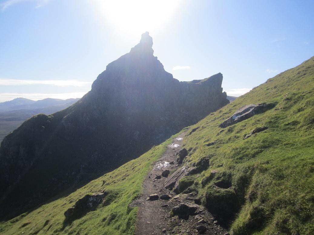
View towards route of Kilbo Path, taken from 'Glack of Balquhader'


Summary

This was a quick tour of the Angus glens, starting from the lowlands and finishing in the highlands. Jocks Road and Kilbo Path were the highlights.

Blog

It's been a ridiculously mild November. The hills were still snow-free, and this weekend's forecast assured me I had little to worry about weather-wise if venturing out into the hills.

Looking NW over Strathardle from Bonnington Road
Musty autumn leaves, Drimmie Woods
8:45am, at a gravel car-park on the A93 by Blairgowrie, standing not too far from the car, feeling a bit nervous (but in a good way), and as usual waiting for the Garmin Forerunner to get GPS reception. My dad and Lesley had just dropped me off and were soon to be on their way up to Spittal o' Glenshee where we'd meet back up and spend the night celebrating my dad's birthday. I was already looking forward to that part of the day.  Maybe not so sure about this first part, which had been a great idea after a few pints, but not quite so great at 8:45am wearing inadequate clothing in a carpark and about to start. Of course by 10am it was making sense again, as is usually the case, once mind and body has transcended into that parallel universe of ultra-running that doesn't expect stuff to make sense anyway.

A Wintery 'Den of Alyth'
The pack was heavier than usual as I was traveling self-sufficient including emergency stuff for the hilly bits ("proper" waterproofs, spare dry layers and a space-blanket). At least I didn't need to lug around lots of water though - part of the beauty of getting out of the glens and up the Scottish hills is there's usually no shortage of good water supplies!

The climbing started immediately, up Bonnington Road which rises out of Strathmore onto the foothills of the Grampians. The sun was already trying to shine from behind banks of mist, and the air was still, carrying that Autumnal smell of damp decaying leaves and vegetation.
After a couple of miles along the hilly lane, I turned sharp right onto a gravel track through the dark Drimmie Woods where I stopped to remove the thermal and gloves - immediately feeling a lot better and enjoying the cool fresh air against the bare arms and hands. Happier.

I've done plenty running and cycling on these wee lanes around Blair and part of me wanted to push the pace early because as always my interest is in exploring the unfamiliar, or at least less familiar, which today meant the more mountainous second-half of the run. The foot of the glens are still a nice enough place to be though, best enjoyed on a bike. As I dropped back downhill to the Den of Alyth, a red squirrel scurried across the road and made a sporadic rush up a tree-trunk.

Looking up Glen Isla from track N of Kilry
My route continued to follow the empty roads around the Hill of Alyth, first N, then W, before dropping down into Glen Isla and briefly joining the route of the Cateran Trail. Having run length of the Cateran Trail before I wasn't too bothered about following its extra-curricular loops up the hillsides, opting to stay on the tarmac so I could get up to the 'real stuff' sooner. This meant heading for Kilry on another hilly lane.

Beyond Kilry my route rejoined the Cateran Trail N towards Kirkton of Glenisla (ignoring the climb up Druim Dearg) then missing my turning for "Freuchies" and ending up continuing up the Cateran Trail as far as Loch Shandra.  No harm done.  "What's an extra half mile in the day's grand scheme?" I thought.  Probably a better route anyway, less time spent in plantation forest.

With a not-too-shabby easy 15 miles done, I was finally stepping onto new turf (okay gravel) where I'd be heading N through miles of plantation, gently climbing towards a pass (title photo) into the head of Glen Prosen.   Time to celebrate with some tunes.  It was quite a boring stretch, but at least I knew I was getting ever closer to the nice bit.

Symmetry courtesy of Loch Shandra
After an initial climb to 400m the forest road curves around a vague pass and almost doubles-back down into Glen Finlet, where a left branch continues the journey N.  Much of the forest here had been felled.  3 miles later the track finished and a bog with bootprints in it continued into thick spruce, following the course of a burn.  It wasn't long before I was questioning my route, it was that shite, but thankfully after a bit of pussy-footing beside and over the burn, and awkardly negotiating a fallen tree, there was a stile.  Out back into the open, heather abound, a tall sign letting me know I was on a right-of-way.  550m, the top of the pass was another 50m above, I found a vague path heading directly towards the lowest point of the pass, and was glad to finally be able to see the slopes of the Munros 'Driesh' and 'Mayar', between which the onward route of the 'Kilbo Path' climbs.

Looking back down Glen Finlet
Took some water onboard at this pass - adding some energy power to it, and scoffing a banana as I descended down to the River Prosen - picking up traces of path then losing it.. There's a bridge across the river, but I couldn't be arsed going down to it and ended up just walking through the river which turned out to be surprisingly pleasant.  Then took to an estate road just N of a small plantation hoping it would be less muddy than the true 'Kilbo' route that zig-zagged through the plantation.  I was still struggling for traction and getting frustrated as the muddy track headed up the steepening open hillside to a lump marked on the map as Kings Seat.  From there it was less muddy, more grassy and so easier going.  I kept an easy run going all the way up into the clouds, and was surprised when I found myself on the 830m summit plateau and approaching the ex-signpost-now-pole.  The cloud broke briefly then closed back in as I turned more E past the signpost then N again slightly too soon, ending up on the crest of the "Shank of Drumfollow" instead of on the good path descending its E side. The cloud cleared and I decided it had been a nice mistake to make as the views down into the corrie were impressive.  Unfortunately I can't show a photo of this because my camera had become wet (oops) and wasn't working too well.

Descending into the forest along the Munro-baggers path I saw my first walker of the day, a girl who had lost her glove, and then I passed the group she was with waiting further down, and then another group after that, and people walking dogs etc.  Yep I was in Glen Doll.

Descended to the bridge beside the Lodge to get to the start of Jocks Road proper, 14.5miles to go to Braemar, and feeling good.  Although it would be getting dark in an hour.

Jocks Road was what I'd really been looking forward to today - sure I've done all the Munros around it many years ago but never had a chance to experience the pass as part of a point-to-point route.  And running!  I'd been inspired by my dad's photos of when he did this route (jb-greyhairrules.blogspot.com), something about the path climbing up the side of the valley into the clouds.

It didn't disappoint.  I took on a cereal bar and more water as I climbed, it was an excellent trail for running and the scenery was nice and rocky.  I made the same mistake as my dad had on reaching the first crest past the 'Shelter', and continued along the boggy flat trail that headed for the riverbank instead of climbing up to the right towards the true plateau.  Someone had thoughtfully put a line of stones across the path to make people aware, and I thoughtlessly chose to ignore them.

Well not entirely - I think I did start climbing up, the way seemed to be petering-out, and my tired legs and mind conspired to cut back down to the easier option.

My Garmin soon let me know my mistake, and I soon let it know what I thought.  I was still thinking I was on the right path because it was so obvious, and the route I'd drawn from the map was wrong, not the route I'd taken. The cloud level rose above my head for a moment and I could see the wild river glen I was in - just the bottom of it - and then decided it was time to stop the denial and start climbing up the rough hillside and find the real route.  The slope up into the mist wasn't steep but the terrain made it hard work as I tried to angle my way back up to Jocks Road.  After 10 minutes of this I felt the need to take my first and penultimate walking break of the day - only starting to jog again once the heather receded, replaced by wind-clipped tundra, and I knew what that meant!

Indeed I seemed to have reached a stony crest, and was soon back upon Jocks Road.  Having discussed this with my dad since I'm guessing I'd pretty much retraced his footsteps to where he'd celebrated by taking his "Invisible Man" photo.  I found the 920m summit of Crow Craigies, and a few minutes later was following rusty old fenceposts through the mist, then taking a sharp L turn along traces of path in search of the head of Glen Callater.

It was a great boost to descend back under the cloud and see the way ahead - the very long way ahead, Loch Callater in the distance, and the very low sun highlighting the hillsides below.  Although it was downhill from here, the first bit was rather awkward, and I felt safer walking after a couple of slips on mossy rock.  I think my GPS route was a bit too far N towards the slabs.

Once safely down on the E side of a tributary I found traces of path, which was improving all the time as I progressed down the valley, and when I found myself on stepping stones across a marshy bit I felt like I had reached the outpost of civilisation!  7.5 miles still to go, and daylight fading.

Stopped to take on some more water at Loch Callater.  I hadn't seen anyone since Glen Doll, and wasn't going to.  I always think there's something special about witnessing nightfall in places like this - no streetlights or cars or noise, just heather and hills.  I enjoyed this as I descended down the 4 miles excellent track towards the A93, stopping briefly to put the headtorch on for when I got to the road.

Fortunately I'd checked with my dad about this next bit - getting to the "back road" into Braemar on the W side of the Clunie Water.  Otherwise I'd have screwed up for sure.  There's no way I would have found my route in the dark, and would have had to endure a dodgy 2 miles along the A93.  The instructions were basically to head up the glen (i.e. the wrong way) on the A93 along the deer fence until it finished, that's about 200m, where a feint track heads off into the heather then doubles back towards a bridge.  Once over the bridge, the path follows the bank of the river upstream again for another 200m before cutting uphill onto the road.

From there, it was an easy 2-and-a-bit mile coast down towards the lights of Braemar. The church bells tolled 5 times as I approached.

Saturday 5 November 2011

Southern Upland Way - Bargrennan to Portpatrick

Distance: 40.1 miles (64.5km) Ascent/Descent: 750m/700m
Start/Finish: Bargrennan to Portpatrick
Terrain: 40% gravel/surfaced road, 35% boggy track/trail, 25% easy trail
Transport: Buses
Route: Route Map | Garmin Course [Coming soon]

Southern Upland Way Stages: Prev [1] [2] [3] [4] [5] 6


Port Kale, near Portpatrick

Summary
There's quite a lot of road walking/running on this section, but there's also a lot of bog to make up for it. In spite of the area being heavily forested, I was pleasantly surprised how open the route was. The first 20 miles does feel very remote, even when "on-road". Towards the end its very different - farmland and country lanes. The best is left to last though - 2 miles of coastal path between the lighthouse and Portpatrick are possibly the best 2 miles of the entire way (in my opinion at least)!


Near the start, looking back towards Galloway Forest Park

Blog
We stayed the Friday night in Newton Stewart, and in the morning I could tell my dad was excited for me as we drove the 8 miles North to where the Southern Upland Way crosses the A714, near Bargrennan. The weather added to the excitement - it was the kind of weather you dream up when planning these crazy things. Pale blue sky, crisp still air, wisps of mist above the ground vegetation that was white with frost. Midgies wouldn't have a chance!
I was running by 9am, the terrain immediately proving a challenge for muscles that hadn't warmed up yet! Feet submerged in bog within minutes, and ankles getting a good workout. The first two miles involved ascending "Glenvernoch Fell", a modest lump but with a good panorama from its summit trigpoint.
I was nicely warmed-up by the time I was at the summit, photographing the new vista over Loch Ochiltree. To the West I could see mile after mile of forest, and that's where I was heading. Although not exactly a dramatic view, I was inspired by what I saw. The vastness and remoteness of it I guess, and that feeling of having part of the world to myself for one day!
After a fun, gentle descent I was routed onto a decrepit road (which my poor dad had driven over earlier!), and after a mile and a bit of this I was off into the woods. It was fairly tricky going at times but also great fun. At one point a fallen tree disguised the route ahead. This forest section was fairly short and I was back onto another deserted road, passing Northwards through a scattering of houses called "Knowe". A fingerpost sent me off this road onto an equally deserted road, and so I was heading West once again.
My dad and I were experimenting with a new way of keeping me fuelled and watered today! Instead of him having to commit to leaving my car somewhere at sometime, we were using 'drop bags' at planned locations, which meant he could have a lot more freedom to do his own exploring in his own time (or just go to the pub). The first of three drop bags was along this minor road, tucked in the bracken beneath a tree, and having shown me a picture of exactly where he was going to put it I had no problem finding the goodies!

Was a bit surprised when a car came along - I'd catch up with the occupants later as they were walking along the Southern Upland Way to check out the "Wells of the Rees". The road downgraded into forest track for a few miles. At one point I stopped, unplugged the music and indulged in a few moments of absolute peace and quiet. Even the gentle North West breeze didn't penetrate the trees around me. A couple of miles later, back in open terrain, thistle posts lead me off the gravel and up a grassy/muddy path to ascend Craig Airlie Fell. The views remained open all the way to the top, and although I wasn't moving forward very quickly I certainly felt I was climbing well, not wanting to walk but not wanting to burn myself up either. I knew from recent training that my fitness and endurance was back to how I like it, and it was moments like these which made it all worth while.

The path almost doubles back as it descends down into the forest, but soon I was standing at a fingerpost marking a short diversion to the "Wells of the Rees". Can't find much info about these curious things, but another mile down the path there were the "Laggangarn Stones" which did have a small interpretation notice. Unfortunately it explained not a lot was known about these either - other than they vastly predate the Christan symbols inscribed on them.
From the stones, a short way down a fire-break took me to the wooden Beehive Bothy! The location was a bit more interesting than I'd imagined - sure it was surrounded by forest, but it was quite open with a burn flowing by, looks like the site of an old farm. I couldn't resist going into the bothy (it was colder indoors than out!) and checking out the logbook, the last entry being nearly 3 weeks ago.
The trail from here was quite good, briefly, then merged onto a gravel forest track, before leaving this to take in a few more swamps. In fact most of today I was either bounding along road or up to my ankles in either moss, mud, bog or water. I've got photos of each flavour below. I didn't moan about it. At first.

I was really enjoying this run in spite of the difficulty, and the miles had flown by. I wasn't counting them - but I did know that once I had "escaped" the forest and descended the moors down to a road by the river, I'd be approaching halfway, and my second drop bag of the day.

After a mile of two of road, the route of the S.U.Way climbed back onto moor giving me this view back over the way I had come (2nd drop-bag had been down by the river).
According to the map this elevated area is known as Kilhern Moss, and the route upon it was a long, straight, muddy and puddle-filled track with a herd of cows beside it. I imagine some S.U.Wayers bypass this section and stick to the road using the village of "New Luce" as a staging post. Once off the "Moss" and down into the Valley of the Water of Luce, it was back to lusher grazing land - the waymarker posts taking me across a couple of sheep-filled fields to "Huftanny" bridge over the river, then up and over a railway line which takes a parabolic route from here to Stranraer. A rough section followed though trees, contouring the muddy hillside with rocks to trip me up now and then, and afterwards I was back into shady pine forest before re-emerging onto a well-engineered trail that reminded me how comparatively tough much of today's off-roading had been! This part of the route skirts "Glenwhan Moor" (which I guess might be called "Glenwhan Forest" these days?) before briefly joining a minor road. A vista opened out to the West and it was clear I had a bit of descending to do, down into a new landscape of arable farmland!
Descending down the fields towards Castle Kennedy, I felt the waymarkers were a bit scarce, but the GPS course I'd taken from the map gave me the re-assurance I needed.
The route does a brief rendezvous with the gardens of Castle Kennedy then arrives at a main road with a conveniently located petrol station and spar shop. Time for some full-fat coke! I was very happy at this point - the scenery was fairly plain here but I was still enjoying my running with only a half-marathon to go. The first stretch from Castle Kennedy was along a nice bridleway through trees, and I had to hold the pace back and try focus on the moment again rather than just "getting to the finish". Then out onto some backroads winding through hedges, with the occasional farm track or horse-churned path. Two of the "bog photos" above show that even down in these relatively tame and cultivated lands, the Southern Upland Way manages to find mud and water to play in.

I was aware that there'd be a final climb before I got to see the coast (and hopefully Ireland beyond!). As I've commented before, there always is a "final climb" on any section of the way. To be honest, this one did start to get to me, not because of the gradient, but because of the subject of one of those "bog photos" above. The worst one. The one with my hand and leg-prints clearly shown. Hardcore cross-country training!
The final hill of the way (or for most, the first hill of the way) was reached - a green lump with a view over the water, and yes Ireland was clearly visible today. As was Arran. From here I managed to get lost for the second time of the day in spite of the GPS - running to a dead-end and back which was a bit cruel given I was so close to the finish! Eventually got onto the correct track, briefly joined a backroad, then a right turn down a lane to Killantringan Lighthouse on the coast. Here followed what was the nicest piece of running this splendid day, and I was both surprised and grateful to have arrived there well before darkness. The coastal trail was good and firm, and the scenery was particularly pretty in the light of the setting sun. My dad had walked this bit earlier, and I let him know he'd picked the best part my day's journey - if not the entire Southern Upland Way!
My GPS told me I only had about 1.8 miles to go, and as I attacked the final hills I had a sad realisation that this was the end of what had been a great little adventure, a project that had started back in January this year, and here I was on the final couple of miles, and they were stunning. I slowed myself down, wanting to savour this, and indulge in the fact I still felt so good considering how far and quickly I had travelled. The sunset to my right was a fine metaphor for the moment.

Portpatrick became visible around the corner, and lived up to the expectation of being a great setting for a finish.

My dad and I had a fun evening in "The Crown" with some fellow runners who were down for today's Stranraer 10k. Yes I had plenty to drink. As promised.

The next morning, on the start of the long drive back home, we both commented on how it seemed a shame it was over. Obviously it wasn't all about the running - it was the fact that these weekends on the Southern Upland Way had forced us to explore parts of Scotland neither of us had really visited before, and stay in towns like Newton Stewart, Dalry, Moffat and of course Portpatrick. We made a point of making the car journey as much a part of the weekend as the running, deliberately taking different routes home.

So, I guess we'll just have to find another project.

Southern Upland Way Stages: Prev [1] [2] [3] [4] [5] 6

Wednesday 12 October 2011

Trotternish Traverse

Distance: 22 miles (35.5km) Ascent/Descent: 1870m/1950m
Start/Finish: Flodigarry to Portree
Terrain: 10% trail, 20% road, 70% open hillside
Transport: buses (57A/C) serves start/end.
Route: Route Map | Garmin Course


Summary
The Trotternish peninsula on Skye has a fine escarpment along its length, the crest
of which, although mostly pathless, is nice and runnable, and offers uninterrupted views (cloud permitting) of the Applecross/Torridon hills on one side, and the Outer Hebrides on the other. But there's plenty more interest close by - this route starts by exploring the famous "Quirrang" and finishes with "the Storr" before dropping down to an easy road-run for the final downhill miles to Portree. I guess its possible to cut out the road and and fit this into a (very) long day walk. I was based in Portree, and used the bus to get to the start (Flodigarry) and wanted to run back to "base".


The start, Loch Langaig

Blog
It was a late start for me. I'd been on holiday for 10 days now and had long forgotten what 7am felt or looked like (leaving that to next week when back at work!).

At about 1pm the bus driver dropped me off just beyond the "Flodigarry" sign, where another sign indicates a public footpath to the Quirrang. After day after day of rain, wind and cold, today was a stunner. I'd almost given up and vowed to save my holidays for the Canaries at this time of year! But today Skye was warm, barely a cloud and barely a breeze.


The path climbs up past a couple of nice lochans, steep at times but not for long, then into the rocky wierdness that is the Quirrang. Other paths branch off to explore, I just kept on the main one which heads for the base of the escarpment and follows it around, heavenly trail-running here, eventually arriving at the ever-busy car-park at the top of the pass where a minor road crosses the peninsula.


Looking S from Bioda Buidhe towards Beinn Edra in distance

It gets much more peaceful from here on, with the Trotternish escarpment stretched out ahead, mile after mile. Traces of a path eventually peter-out on the way South to Bioda Buidhe, but the relatively gentle gradient and grassy terrain mean it remains very runnable.

After this initial top, I made the mistake of continuing down the tempting slopes South and had to backtrack uphill slightly on awkward clumpy slopes to negotiate a big gash in the hillside!

It seemed like a long way onwards to 611m Beinn Edra, and instead of sticking to the crest I tried to cut the corner after Bealach Uige, which was swampy and slow going. For most of this section there was a good view down into Uig.

As I progressed South I noticed the ups and downs were getting steeper. Since Edra the ridge had narrowed as it took in a succession of summits. I was getting rather thirsty - as you'd expect there'd been no flowing water along the crest. Thankfully I found somewhere to fill the bottle in the Bealach Chaiplin on the slopes of Flashvein.
Knowing I'd be running out of daylight I cut out the promontory of "Sgurr a Mhadaidh Ruaidh" and headed straight for the next summit. There were more opportunites to fill the bottle after here. I descended the brilliant Bealach Hartaval and struggled up Hartaval. "The Storr" now lay ahead - the highest (and for me ultimate) summit of the day. Descending Hartaval to the bealach took a bit of care cutting down through broken crags (the further W, the less crags), and as I descended, the onward slope of the Storr looked imposing. It wasn't as precipitous as it looked, but I finally succumbed to a walk here. Having studied the map before setting out, I knew I'd be walking this bit! The view from the summit was the best of the day, as the as the Cuillin were now much closer and the view of them was now uninterrupted.

From here it was an easy downhill run to the Bealachs "Beag & Mor". At the latter, I picked up the start of a track descending East into the shadow of the escarpment. This track petered-out and I was soon making my own awkward way down to the nearest burn, finding it easier to run on marshy grass than leggy heather. Eventually came out onto the road "A855", and the tarmac felt incredibly easy after this long mostly pathless day! I felt strong again so really picked up the pace, wanting to get off the main road and down to Portree before darkness.

Friday 7 October 2011

Harris Walkway

Distance: 23miles (37km) Ascent/Descent: 590m/520m
Start/Finish: Luskentyre Beach to Ardvoulie
Terrain: 20% road, 60% Good path, 20% Swampy path
Transport: Bus Services for both start/end
Route: Route Map | Garmin Course


Summary
I can't understand why such a great official walking route receives such little promotion! I had never heard of the "Harris Walkway" until browsing through tourist brochures in the Hotel at Tarbert. Even the brochure offered a mere hint as to its existence - a set of straight dotted lines across a map of Harris, accompanied by just a paragraph with little clue as to what the actual route involved. So I got myself online and started searching the internet expecting to find dedicated pages about this "walkway" which was opened in 2001 by Cameron McNeish, but all I found was other walkers' exclamations at the lack of information available, along with sparse accounts and a couple of photographs.

Admittedly, on inspection of an OS map of Harris, and given the start and end points (Ardvoulie to the N of Tarbert and Selibost to the SW), the route any road-avoiding explorer would choose is fairly obvious. A series of old tracks cut through the hills of Harris, and the Harris Walkway basically links them together, with just a little bit of road walking in between.

Some work has gone into this walkway - sections are marked with a plaque at either end (many now faded), giving a brief description in English and Gaelic. Also every section has at least one strategically placed bench providing a fine place for lunch or a breather.

The excellent Hebrides Transport bus services visit both start/end points. I based myself in Tarbert (ferry from Uig, Skye), and in the morning took the bus down to Luskentyre, ran from there back to Tarbert, then at 4pm took a bus N to Ardvoulie and again ran back to Tarbert. It would make a pleasant, unstressful two-day end-to-end backpacking trip with plenty idyllic camping spots to choose from.


Blog
After cycle-touring slowly up the Uists from Barra during a stormy week, negotiating cancelled ferries and dangerous side-gusts, it made a nice change to wake up to a cloudless blue sky in Tarbert. Swapping bike shoes for trail-running shoes, I boarded a bus for Luskentyre, back over the rocky pass I'd pedalled over a couple days earlier, and the driver knew exactly where to drop me off to start the coast-to-coast first section of the Harris Walkway along the "Coffin Road". Some steps up from the road lead to a style (title photograph), and I found myself on an old section of moss-covered road leading me towards the Bealach Eorabhat.

The going remained easy and it wasn't long before I was at the summit, encountering the first of many benches on this walkway. The ocean was visible to East and West.
The continuation from there became much rougher, lots of leaping over bog and an occasional bit of sinking, tall marker-posts indicated the way down. After barely more than 3 miles I was on the other coast of Harris, where the route shies away from the possibility of tarmac and instead negotiates a rocky lump then meanders through one of the rockiest scenes I've seen in Scotland. Sure enough an information board declares that this area was used in Stanley Kubrick's '2001 Space Odyssey' due to its moon-like landscape.
After passing a lochan, a track joins from the right - this was my onward route, taking me down to the road junction and a plaque that described the "Coffin Road" I'd just followed.
From here at the head of Loch Stockanish, I followed the tarmac briefly uphill (ENE), until a tight left bend where a small gate (on the right) offers a route of escape back onto open hillside. A path is shown on the map from here, even though there isn't much evidence of one at first. Shortly I was once again encountering occasional way-marker posts and there became evidence of a seemingly old, well-engineered track, which these days resembles a carpet of marshy grass rolled upon the rocky terrain.
There was always a nice view over the complex coastline to the sea, and the hazy outline of Skye's Trotternish Peninsula was visible beyond. The route meets what's presumably an ancient T-junction, and after a quick consultation of the map I turned left to run initially steep uphill then attaining an impressive section of "carpet through the rocks".
It snakes down past a couple of lochans eventually arriving at a tiny place called Greosabhagh, and here a short but enjoyable bit of road-running begins. I never saw a vehicle on the 1.5 miles of road which took me to the start of the next section of old trail, with nice views of the Clisham Hills of North Harris opening up.
Another brief section of tarmac took me through Meavaig, just after which I spied the next little "plaque" on the right-hand side of the road, where a vague track skirts down the verge towards a very modern-looking wooden bridge. Again this is a section of "old road to Tarbert". The all-too-familiar dark clouds were back in the sky by this point, and so the rain was soon coming down to make sure I got soaked before I reached Tarbert. There's a final section of road, and a final small loop of old-trail, before reaching the port. From start to Tarbert, I'd clocked only 15 miles, and after a pint of 80 schilling in the Hebrides Bar I was up for seeing the final 8 miles, taking advantage of the scheduled 4pm bus to Ardvoulie so I could run back to "base" in Tarbert.
It was clear the heavy showers were back to stay as the bus took me North over a soggy Clisham Pass and down towards Ardvoulie. This part of Harris is much more mountainous. I spotted the usual "plaque" at the road-side and the driver kindly let me off the bus at an unofficial stop before Ardvoulie so I didn't have so far to run back uphill on the road! Sure enough a little sign here commemorated the opening of the Harris Walkway by Cameron McNeish in 2001.
The route starts off very soggy, but green-soggy rather than brown-soggy which meant I was probably a bit cleaner by the time I got to the top of the pass it climbs. I was really enjoying the afternoon/evening light when the sun did shine, I find its always special to be in places like this for the last few hours of daylight. One of the route's benches had been blown over up here, so I lifted it back into its right place (until the next storm hammers it in a week or two's time no doubt). Its a shame to see how faded the writing on the plaques are, some even cracked in half.
The walkway rejoins the main Stornoway-Tarbert road but not for long, and soon I was descending the road down to Loch Seaforth with nice views over the water. Near the bottom of this descent, another plaque marks the start of the final section of the walkway (in the twisted order I've done them, that is) back to Tarbert.
A couple of modern wooden bridges took me over waterfalls and the route continued almost roman-like in its straightness up the hillside. As always, the gradient was gentle and the pass was relatively low. A final bench offered the option of a break beside the Lochan nan Lachasdail, before the track climbed away to meet tarmac and the final mile West to Tarbert.

Saturday 24 September 2011

Southern Upland Way: Bargrennan - St. Johns Town of Dalry

Distance: 25.1 miles (40.5km) Ascent/Descent: 490m/510m
Start/Finish: Bargrennan to St. Johns Town of Dalry
Terrain: 45% forest road, 15% surfaced road, 25% Rough trail, 15% Easy trail
Transport: Very limited: Dum & Galloway bus timetables, and Kings Coaches
Route: Route Map | Garmin Course

Southern Upland Way Stages: Prev [1] [2] [3] [4] 5 [6] Next


Summary
This section of the Southern Upland Way has a more "Highland" feel about it, crossing Galloway Forest Park near its more rugged peaks. It never ventures onto the higher terrain, keeping to the forested glens with only a couple of gentle passes involved. The character is always changing, from leafy riverside and lochside trail at first, to more open and desolate country scarred with expansive forestry, but finishing with a pleasant wooded descent (albeit on tarmac). A final modest climb up Waterside Hill is well worth the effort, giving the day's most open view of the surrounding countryside, with Dalry just an easy mile below.

Blog
Its been too long since we last did this! Back exploring the Southern Upland Way, and the surrounding area. September/October is my favourite time of year in Scotland - weather's still mild, but the midges aren't so bad, the heather's still out, the bracken is golden and the leaves are just starting to put on a show.

Just South of Bargrennan (I must have blinked when we drove through), there is a layby close to where the Southern Upland Way crosses the A714. The sun was reflecting brightly off the road, wet from a recent downpour. I knew from a phonecall with the Ken Bridge Hotel, where the campground was waterlogged, that today promised to be a very squelchy day.
I set off very relaxed onto the river-side trail, soon becoming less relaxed as the wet tree-roots seemed to be trying to send me down into the water! Reckon my socks were already soaked and my legs sprayed with bog within the first mile.

I overtook a couple of lassies taking their mountain-bikes for a walk, then the route did become firmer and the trees backed-off giving me a few glimpses of the surroundings. Yes it was boggy in places but all runnable and the river-side setting way very pleasant, I was happy to be back running the Southern Upland Way again.


After passing through the abandoned campsite at "Caldons", the character begins to change as the steep-sided and forested slopes of Glen Trool are entered. I was still feeling fresh enough to enjoy all the seemingly pointless short-sharp ascents and descents through the trees, and had to stop several times so I could take in the occasional view across Loch Trool.
I could see across to Bruce's Stone, and above it the trail through the Bracken which forms the start of the Merrick Hill race.

At the time I ran this, they seem to have re-routed the S.U.W. along the forest trail (sharing it with Cycle Route 7) instead of the way marked on my map (which heads ascends the same watershed but by a more open, rougher route). I didn't mind, don't think there was much difference between the views. There was certainly a difference between one side of the watershed and the other, however, as the land opened out and Loch Dee presented itself below. This was one of those sections which I think might be a bit tedious to walk - forestry road is fine in short stretches but mile after mile with squares of logging operation on either-side, not so great!
It did give me the chance to stretch-out the stride a bit, and so it wasn't so long before I was above Clatteringshaw's Loch, and looking out for my dad somewhere on the trail ahead. We met up where the route becomes a trail again, and I admitted to him he wasn't missing out on too much if he turned around to go back from where he was! I followed his footprints back up the squelchy/stoney path up a firebreak and out onto open moorland. Only 5 miles to go from here, and mostly downhill.
Which was a good job because my legs were beginning to stiffen up and I was ready for a pint or two. The descent went from trail to track to tarmac, my car sitting where my dad had left it so I could pick up a change of dry clothes and be slightly more presentable at the pub. The road down was pleasant enough - helped by lack of cars - but it was nice when a fingerpost sent me off it down to the riverbank instead. Over a bridge and into a field with a swamp and a bull in it, I sank nearly up to my knee in a marsh as I tried to keep as close to the fence and as far from the bull as possible.
Was glad to get to a style and onto bracken-covered hillside, and start ascending the final wee hill of the day, which was easier going than I'd prepared myself for. And nicer too - the view from the top, both looking back over the Galloway Forest Park from where I'd come, and forward over Dalry, the destination, with distant lake-district peaks visible.


Got to the Clachan Inn, two minutes later my dad was there too, and we were sitting in the sunshine with beer and a post-exercise buzz. We were both glad to be back to the "Southern Upland Way" project, and already making plans for the ultimate stage - Bargrennan to Port Patrick, where we have decided it would be nice to jog the last 5 miles together to complete what we started in the frosty early months of this year. We're both going to have to get a bit more training in!

NOTE: This is what this section of the Southern Upland Way does to your legs.

The next day (Sunday) we did a nice short walk in "Ness Glen" a few miles to the North by Loch Doon - a gem of a gorge walk.

Other Southern Upland Way Stages:
Prev [1] [2] [3] [4] 5 [6] Next