A runners perspective


I hope this blog is of use/interest to walkers, runners and cyclists living in or intending to visit Scotland. Most of my entries below are described as long-distance runs - just because that's currently what I enjoy doing...
Showing posts with label northern highlands. Show all posts

Saturday, 18 January 2014

Speyside Way - Part 1

Distance: 50miles (80km) Ascent/Descent: 1260m/1070m  
Start/Finish: Buckie to Grantown on Spey  
Terrain: Mostly easy river-side rail-trail, some long stretches of tarmac, boggy hillside for 7 miles after Cragganmore 
Transport: train to Elgin then good early bus service to Buckie, train and  citylink bus services at Aviemore Route Map1/2 | Route Map2/2


Summary

There's plenty great info on the Speyside Way online, but I struggled to find many blogs covering exploration of the whole thing.  Most blogs that I did find were runners race reports from the Speyside Way Race, which covers the original 36mile length of the route (before it got extended to Aviemore and Buckie).  Being low level and never too far from civilisation it feels like a good Winter option.  The public transport at either end worked out well, allowing a 7am start from Buckie in spite of catching the train to Elgin late on Friday and staying the night there (plenty buses, and not so many trains South from Aviemore in the afternoon/evening).

Blog

It's still dark, not long past 7am on a Saturday morning, three of us running briskly along a frosty railway path directly towards a full moon, sound of waves crashing against the nearby shore, and the whole day ahead to look forward to - just brilliant!  For one day at least, we had become part of those annoying morning people who get up and "do stuff" before everyone else wakes up.  (And then post about it on Facebook).

We left the square in Buckie and with some success followed the waymarkers along the coast, squashed between the road and shingle.  It was dark and I'd never been here before so can't really describe what we were missing, but we weren't missing lots of puddles and stones!

Daylight was imminent as we entered the woods near the mouth of the River Spey - this bit of singletrack was a blast, then out of the trees and past the old empty hotel and along tarmac to the wildlife centre.  Dolphins are a common sight from here.  This morning we just had to make do with a cloudy sunrise and the sounds of breakers somewhere behind the dunes.

From here we were finally heading more S along the bank of the river, starting the journey upstream towards the Aviemore and the Cairngorm National Park.  At first the scene was very flat, farmtrack beside fields of stubble and muddy woodland, then after a few miles of this we were running under the A96 road bridge and into a park on the edge of Fochabers, where the first of many forested hills roll up above the Spey.  The river was always closeby on our right.
Earth Pillars Viewpoint (after Fochabers)

You don't see much of Fochabers from the Speyside Way itself, which heads away from the river along a burn then routes you back S past and around the school to join a singetrack tarmac road.  The next few miles of the route are along this, which from the few other blogs I've read can be a disappointment for walkers, but for runners/cyclists its pleasant enough I thought - climbing immediately up onto hillside, traffic rare, views opening out.  On top of the first rise is a sign for "the Earth Pillars", and curiosity got the better of us so we followed the narrow path into the trees in search of them.  What we found was a nice viewpoint above the river, but no pillars.  It was only after returning to the Speyside Way road and following it down into a deep gully and steeply up the otherside that we understood.  Looking back across to where we'd been, the steep hillside itself was composed of pillars of earth rising above the Spey.  The road here would make for great cycling - challenging but pretty.  Today we had to be very careful with black ice.  Knowing we still had a long journey ahead of us, we took a brief walking break on this hill (its a great excuse) then enjoyed some relaxing downhill tarmac through thick pine forest before emerging onto open hillside that allowed inspiring views over the Spey and to the higher hills cloaked in haze beyond.  That's where we were heading!

The road drops down to Boat o' Brig, an impressive structure, but rather than crossing the river here the route zig-zags offroad up into the trees and so begins the climb onto the shoulders of Beinn Aigan.  I really enjoyed this bit - again other blogs have understandably groaned about the forestry and lack of views, but there was something really nice about the track up through the trees here, really peaceful running country.  And after climbing to 200m altitude we were rewarded with another just-off-trail viewpoint back downstream towards the coast - looking very distant now!

The forest track starts descending, occasionally threatening to climb again but generally allowing downhill coasting, back off the sides of Beinn Aigan to meet another country road by the river.  This is followed to the A94 just N of Craigellachie, where a sign said "Bar" and I so started talking about Guinness, and would continue doing so for the next 25 miles.

Here we made our rendezvous with Norrie, who would join us for an out-and-back run along the Speyside Way (he ended up clocking a marathon!).  Again the way doesn't really enter town, but I needed some water or sports drink so went in search for some, ending up at a garage on the road to Dufftown before I found any so owed an apology to the others by the time I rushed back down.

Looking back to the coast from Ben Aigan (not picnic time of year though)
So now there were four of us heading along the bank of the Spey along old railway trail, the river always near.  Again Aberlour was bypassed closeby on the left.  It was really nice, easy running along the rail path, very enjoyable even on tiring legs.  The Spey wound its way through the hills, quite closed-in at times, and the scene was of damp winter colours (reds, golds, browns of the trees and bracken, green fields with sheep, grey river and sky!). 

I can't describe the speyside way without mentioning distilleries, we passed a fair few, some right against the path.  There were also "preserved" railway stations that I recognised from photographs - Blacksboat being one.  Surprisingly not very many other people about along the way today, I guess it is early January, but I can only remember seeing two groups of cyclists, and I can't recall seeing any backpackers!  We had been very lucky with the weather.  When I'd planned this weeks ago I had kind of hoped for a crisp winters' day with a coating of snow, but what we had was fine - a cool cloudy day and a light wind from the S, which we were sheltered from in the valley and trees most of the time.


After what seemed like miles and miles along leafy railway path by the river, we crossed the Spey and arrived at Cragganmore where Fionna's dad was waiting to take her back home after a 34mile morning's run!  Dad's are great.  We took photos, said goodbyes, then it was just me, Carrie and Norrie for the next bit, heading W along the river.  Norrie had ran more than he planned but was fair chuffed when he realised after another kilometer he'd have covered half a marathon, which meant a marathon by the time he got back to his car at Craigellachie!  So shortly he was saying goodbye to and it was just two of us left to continue the journey along the Spey.
Bridge by Cragganmore

Its not long after Cragganmore where the scenery changes quite a bit - mostly because the route departs the railway and river bank and heads S up onto boggy hillside, and so the enclosed river-side is left behind and quickly we found ourselves surrounded by an open landscape of rolling heathery hills, the Cairngorm National Park was getting very close!  Again I found it quite inspiring - the flat farmlands and coast felt a long way away now.

This was the start of what's described as the "toughest" section of the way.  Its all relative of course - the Speyside Way is generally very easy, but after running 36 miles the  boggy ups and downs along hillsides are never going to feel like a stroll in the park!  The route climbs to cross the A95 road then climbs some more up through birch and onto muddy forest track.  I commented to Carrie how chuffed I was that we had got this far in daylight.  We'd covered the ground a lot quicker than I anticipated having assumed we'd be in darkness now, navigating by headtorch, which other than the obvious "training benefit" really defeats the most of the purpose of doing this stuff, for me anyway.  Neither of us had been along the Speyside way before (well the bit as far as Nethy Bridge anyway) which was much of the appeal of doing this route.

We were now traversing the NW slopes of the Hills of Cromdale, the Spey lost somewhere below on our right, the hilltops lost above grey murk above on our left.  And then the drizzle started.  The next few miles were up and down, forest track interspersed with sections of mud, tufty grass, bog, often enclosed by fences, lots of gates, lots of stepping stones which were hazardous due to a coating of icy moss, and more often than not I opted for the safer if unpleasant cold-wet-feet option!

Some more gates, fences, mud.  Yes I was tired now, and I had enjoyed my day but by this point I was counting down the kilometers to a warm hotel in Grantown and never mind one pint of guinness I was now thinking more a "sesh" of guinness.  Maybe the bar would have some Cairngorm Brewery beers too.  Carrie was after fish an chips, then beer.  It all felt like fantasy here on the cold damp hillsides.

"10km to go!" I announced, somewhere on a steep uphill section which entered thick spruce forest ahead.  I had my phone with the route on it so generally knew exactly how far was left.  We'd recently just passed a stone plaque with the Cairngorm National Park logo on it.  And it was still daylight - although the sky was darkening very, very slowly.  And having not eaten much today I was feeling the cold a bit more now!

I knew we were on the "penultimate" hill of the day before dropping back down to the Spey, the A95 and the railway path again.  When we got there, it really did feel like the final stretch, just 3 miles to town, and mostly easy going.  Back to flat fields, with the village of Cromdale on our left.  We crossed the Spey for the final time today via a tarmac road, and then onto a really nice woodland path which took us into Anagach Woods - pine trees and carpet of heather.  We clocked the "50mile" mark somewhere in here.  It was near-dark in the woods, but we could still just about manage without headtorches, and soon I was able to announce "Civilisation!  I can see a street light!"

We emerged from the woods at a Speyside Way info sign at the bottom of a lane, and agreed to stop running there.  The hotel was found, eventually, and I made contact with the folks who were up exploring the area too, and so it wasn't too long before we were enjoying the beer, food, warm clothes and great feeling of satisfaction in the pub.

Wednesday, 3 April 2013

Killilan Loop

Distance: 34.3 miles (55km) 
Ascent/Descent: 1160m/1160m  
Start/Finish: Killilan, near Kyle of Lochalsh
Terrain: 80% gravel track, 15% feint grassy trails, 5% heather/bog 
Transport: train station at Attadale which gives good access to route.  I parked car at Killilan.
Route: Route Map


Summary
There's a vast area of wild country E of Loch Carron, NE of Loch Alsh/Loch Long, labelled Attadale and Killilan Forest on the OS mapOriginally I'd planned to backpack through it years ago.  The loop I've described here is relatively easy compared with most other routes in this blog, as there isn't much climbing and it keeps mostly to good tracks There is a short (1 mile) rough section of bog-hopping Nof Pait Lodge.  It is the remoteness that is of interest here - particularly felt when entering Coire nan Each N of Loch Mhoicean. The map link above shows the route in reverse - i.e., I actually did it anti-clockwise.  That way the last 10 miles were closer to civilisation, with a pussy-out option above Attadale Station.

Blog

The track through Glen Elchaig
The morning was grey and freezing.  That first five minutes after leaving the comfort of a warm car wasn't great, jogging a tad nervously in the direction of snow-speckled "nowhere".  Sure I'd left a crappy hand-drawn map of my planned route with my dad, and I was carrying plenty spare layers in the bag just in case, but it took me a good few miles of running up the estate road into Glen Elchaig before I began to chill-the-hell-out and enjoy what I was doing rather than worry about it.  I wouldn't meet a soul out there - not  until I got back to my car 7 hours later.  So if that's what you're after....

Looking towards Carnach along the shore of Loch na Leitreach
The first few miles were not so wild, but nice and easy going.  I remember lots of sheep and deer loitering by cylindrical feeders.  A few miles on and the surrounding hills close in and steepen a little, the place seems littered with rocks and the gorge of Glomach Falls comes into view to the South.  Loch na Leitreach gave me the creeps.  It was impossibly calm - not even a duck's fart.  It  reflected the hillsides so perfectly that I was only made aware of its existence when the I sensed something wrong about the movement of the landscape to my right.  It became a bit more obvious once around the corner where there was some sky bouncing of it.

The way continues easily up the glen, sneaking past Cannach and Iron Lodge, before the only significant climb of the day where the path loops upwards into the wild.  Back down at Iron Lodge an alternative route heads for nearby Loch Mullardoch - a loch surrounded by infamously remote Munros.  My onward journey was on their arguably more remote NW side, climbing up beside frozen waterfalls to the iced-over Loch Mhoicean.  I could feel the cold a lot more up here, there was now a breeze and it penetrated my gloves.

I don't think much happens around here - Coire nan Each
Beyond the loch and starting to descend, the obvious track onwards is the wrong one - a cairn on the right marks the true "path" down on the grassy side of lonely Coire nan Each.  Those tempted to continue by the easy obvious track will finish in the Heather of Doom (yet to be labelled on the map).

Its more like a piece of archaeology than a path to be honest, but its nice and bouncy, with leaps over bog and burn.  Towards the bottom it is more obvious, and where the glen narrows and the river is close, its continuation differs slightly from the map and so I missed my intended route (the one in the link above and marked on the map) which contours around the Corbett of An Cruachan, instead ending up with a harmless 0.5mile detour down to the bottom - a flat area of peat bogs, heather and lochans (Heather of Doom 2), but saved by another old path linking Maol Bhuide Bothy (interesting link) to Pait Lodge.


Allt Coire nan Each
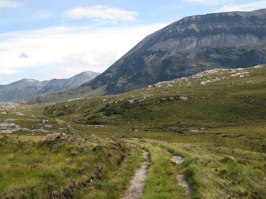
The track to Pait Lodge improves significantly (title photo) and soon I was dropping easily down to the gate beside the lodge snuggled up beneath a conifer plantation.  Stretched before me was Loch Monar, the head water of Strathfarrar - indeed I had descended onto the Eastern watershed of Scotland.

Loch Monar and Pait Lodge from the Heather of Doom III
From Pait Lodge, its over the bridge into Heather of Doom 3 - a mile of traversing slightly upwards and Westwards, negotiating peat hags always by means of the higher and drier rockier ridges. There's a path marked on the map, but the map is a liar.  I contoured where possible so I could tackle this at a run and get it over with, but taking a good long breather higher up to soak in the surroundings of course!  The terrain remains pathless for another mile or so but it gets easier (the GPX route in the link above does lead directly to the excellent Landy track I was heading for).
Snowy An Riabhachan (L) and Sgurr na Lapaich (R) above An Gead Loch, seen from the NW
An Socach (L) dwarfing the very remote Corbetts An Cruachan (M), and Aonach Buidhe (R)
(I'd descended between the Corbetts earlier, heading "left" above those lochans)

Once onto the landy track, the going gets easy again, contouring back to the Scottish Watershed at Loch Calavie, where for the first time today I was on familiar territory (I'd run from Strathcarron to here back in 2010 whilst bagging the "Loch Monar Munros").  Like my hands earlier, the loch was partly frozen.  The track descends past Bendronaig Lodge (another Bothy), does a loop to take in a solid bridge and then its time to start working those tired legs again - a modest climb of 150m on a good track to attain another watershed and feel re-united with civilisation on the other side!  The big Attadale plantation forest comes into view, and the long town of Strathcarron is visible.

 I'm sure a few mountain-biking Munro baggers have haired down these hair-pins over the years. It was actually quite sunny by the time I got here, and for the first time today I felt quite warm.  And very thirsty.  Just a few miles left, and mostly easy ones at that.  After descending to the forest, a fingerpost (civilisation like I said) marks my onward route "left" back to Killilan, "7km" I think it said.


Looking back N from the Killilan-Attadale path
Looking over the River Ling with Faochaig (Corbett) above
The route is fairly easy to follow, descending down to the river, until the path seems to lose itself in some ruined shielings (it goes above them and drops down to the river confluence before swinging almost back on itself to gain a footbridge).

From here it was less than 3 miles back to the sun-heated car, and I was so glad to get there and down some water and junk food, feeling very satisfied with my day.

Friday, 13 April 2012

Torridon and Damph Loop

Distance: 39 miles (62.5km) Ascent/Descent: 1220m/1220m
Start/Finish: Strathcarron Station
Terrain: 50% good trails, 25% Forest track, 15% Vague/Rough trail, 10% surfaced road
Transport: train station at Strathcarron (infrequent)
Route: Route Map


Looking back N over Glen Torridon towards Beinn Eighe (from Bealach Ban path)

Summary
This loop takes in two passes through the mountains between Strathcarron and Torridon, including a scenic trail through the Torridon giants of Beinn Alligin, Liathach and Beinn Eighe. At time of running, refreshments were available at the nice store/cafe in Torridon village.  This is a wonderful area to explore by foot, with numerous tracks cutting between steep-sided mountains.  I ran the loop clockwise, which has the advantage of tackling the roughest part of the day when freshest.  However, I had to regularly stop and look back as the opposite direction seemed to offer the best views.  (I have no problem with regularly stopping and looking!)

Blog
Looking over the head of Loch Carron from above Tullich
 Inspiration for most of my running routes come from just staring at OS maps, joining together paths that look like they go through somewhere interesting.  If I'm greedy my route choice gets distracted by nearby Munros or Corbetts.  On this occasion I'd already sated my appetite for summits having done the South Shiel Ridge a couple of days prior (and the fact I'd visited most of the summits in this area in the past) I was keen to explore the tracks through corries and bealachs instead. 

My day's run started at Strathcarron Station at the Southern-most point of my loop.  The sky was clear and the wet, brown hillsides were lit by a low sun.  I'd had to scrape ice off the car this morning.  I settled into an easy run along the road to Lochcarron.  My route of escape into the hills was at the gate for Tullich on the A896 (there's a gate on right-hand-side with waymarker arrow).  The arrows took me on a non-intrusive route around the houses, the boggy path still frozen in places, then I was onto a very wet and rough track into the hills.  I eventually lost this track in bog.  The OS map suggested the route was on slightly higher ground to the W, so I ascended, following some deer for a bit, then came across old mossy cairns and traces of path again.  I found it hard work, but with hindsight I can say this was the hardest part of the day, both in terms of effort and route-finding.

Hazy ridges of Attadale, from the summit of Bealach a Ghlas-chnoic

Beinn Bhan (from E) over the Allt a Ghiubhais
Higher up the Bealach its easy to get routed away to the W by the course of the burn, whereas the "path" crosses this and heads NW over rocky lumps where views open up down the other side.  From here a rough track winds down quite steeply at times back towards sea-level. 

Do not cross the bridge into the woods like I did - I quickly realised my mistake and retraced my steps back over the bridge and onto a less-obvious continuation of the track down towards the Moine Mhor.  My route disregards the OS map at this point and follows an unmarked but good track N across the wetland to Kinloch Damph at the base of Loch Damh.  Additionally, there is no longer a bridge over the river at Kinloch Damph - but your trailshoes will be soaked by now anyway so wading across is no problem.

Loch Damh
A wooden fingerpost by the ex-bridge marks the start of the "Loch Damh walk", a great loch-side trail that would take me over to Torridon without a road or car in sight (well until the end bit that is).  I stopped for a break above this beach (photo) as it was such a nice spot.  From here the wet trail proceeds through pockets of newly-planted native woodland before arriving at a fishing lodge, from where a wide track, presumably maintained for access to the fish farms, continues the route N down to Loch Torridon.  Beinn Alligin looked nice and sunny across the water, however the bulk of Liathach was cloaked in menacing cloud and it wouldn't be long before I'd get my first wee blast of hailstones.

The road alongside the incredibly clear and calm water of Loch Torridon


A hail shower moves across Loch Torridon, Beinn Damh behind
On reaching the A896 above the loch, I crossed the road slightly to the left where a new signpost marks the start of a good track along the shore (presumably an old section of road?) to Annat.  As I arrived at the Torridon Hotel, the grounds-keeper (I think, judging from the attire) approached and asked me if I was training for the Triathlon, which makes my run today look soft!  He told me there was a path that cut the corner to Torridon Village ahead, so its possible to do even less on-road running around the loch than I thought.  I missed it and continued on my planned route to the junction and the Youth Hostel, campsite and toilets.  A short jog down the road from here and I was enjoying a fantastic slab of carrot cake and cappuccino in the new cafe/shop, with a view back across the loch to where I'd been running earlier.

From here I was lured by a waymarker onto a nice trail above the road - another section of old road perhaps?  It was nice to be back off the tarmac but I warn you that you have to drop back down to the road when the next waymarker post tells you otherwise its a rough passage through boulders and scratchy bushes!  With hindsight I'd have just stayed on the road - which is very quiet and means I could look at the scenery for a bit rather than where my feet were going.

Looking E towards Beinn Eighe, snow on Liathach visible top right
Soon I was at the busy carpark beneath Beinn Alligin and the start of the track around to Coire Dubh - the next leg of my journey.  The first few kms along this trail are heavenly - a gentle slope and a feeling of progressing easily up into dramatic mountains!  A very low-flying propeller-powered aircraft (a Hercules?) rumbled overhead, just a couple hundred metres or so, it looked like it was coming down to land in the glen ahead! 


Liathach from the NW
The sun was shining again, and it felt warm for a moment while I stopped and chatted to a couple coming the other way.  As I progressed E behind the impressive bulk of Liathach, the terrain became very rocky, and progress became much tougher as the large boulders and bog broke up the rythym.  Hailstones were followed by snow, it became very cold when the sun wasn't shining and so the layers were on and off many times for the rest of the day.  Once past Loch Grobaig the route joins the very popular route to Beinn Eighe's Loch Coire Mhic Fhearchair (a fantastic wee walk in itself), and the progress is much, much faster along this good maintained track down to the road.  I didn't encounter anyone on this path in spite of the full carpark - everyone else must have been up on the summits!  From here my run followed the road for a short distance E over a bridge to a green right-of-way sign marking the start of the through-routes to Achnashellach and Coulags (my final pass of the day).

Liathach over Lochan an Asgair
This next section of trail was excellent.  A narrow gravel ribbon up past a waterfall and back into the hills.  I made fast progress up this at first, but as it steepened it also deteriorated and so I took a tactical picnic higher up with a great view (title photo) back N over the glen.

The gradient does eventually relent, cairns now marking the way on rocky but drier terrain as I found myself looking into Coire Grannda.
Coire Grannda
Bealach Ban
The way onwards for me was not into the Coire, but instead a SSW traverse, crossing the burn above a waterfall and picking up the excellent and obvious path over the Bealach Ban at 540m.  The path drops down steeply at first then contours SW to a junction with another path rising towards Bealach na Lice.  Here I turned left (downhill) towards the lochan below, the trail remaining good all the way down to the Coulags Bothy.  There was no one staying at the bothy when I took a nosey around.

Coulags Bothy

From here it was a gentle drop down to the road.  I was looking forward to my dinner by now - a family meal in the Plockton Hotel booked for 6:30pm!  After following the A890 Lochcarron road SW for a few minutes, I was able to escape the tarmac just before a picnic spot where a sign marks the start of a woodland walk to Strathcarron down along the river, where salmon pools are marked by signs ("Johnny's Pool", "Hill Pool").  The waymarkers lead me back to the road bridge over the river where it was a short final sprint along tarmac to beat the next squall.  Great day out (and just part of a brilliant week with family in Plockton).

Tuesday, 10 April 2012

South Shiel Ridge

Distance: 27.5 miles (44km) Ascent/Descent: 2000m/2000m
Start/Finish: Cluanie Inn, Glen Shiel
Terrain: 30% gravel/surfaced road, 60% good trails, 10% ridge-top, mild scrambling
Transport:
citylink bus services Cluanie Inn (Gla/Edi - Skye service)
Route: Route Map


Descending on Maol Chinn Dearg

Summary
A munro-baggers' classic, this ridge of 7 munros lies to the South of Glen Shiel and the road to Skye. After completing the ridge from East to West, the route follows a stalkers path S into the remote Glen Quoich, and with most of the hard work done a great trail-run takes you back beneath the summits along Glen Loyne, then over a small Bealach to the estate road leading back to the Cluanie Inn.

Blog
I'm really glad I went for it. Leaving Cluanie Inn on the road to Cluanie Lodge, with the Loch still and reflecting snowy peaks, my sense of adventure was there but a bit dampened by the expectation that I'd probably encounter ice along the ridge and have to turn back.

A good track leading to the base of Creag a Mhaim
I enjoyed gaining height easily up this gently-graded road above Loch Cluanie, eventually to a 430m Bealach from where I started expecting to find a stalkers' path branching off onto the SE shoulder of Creag a Mhaim. The snow-level was only about 300m above here.

The path did appear on the right just before a little bridge, and it looked nice and gravelly and so very runnable. After a km or so this path forks - I was heading right up onto the ridge, but later today I'd be returning here from the left.

Loch Loyne from the SE ridge of Creag a Mhaim
The path up onto the ridge remained excellent, zig-zagging to take the sting out of the ascent and so I was quickly up into the snow. Surprisingly there were no bootprints in it!

As always it felt good to reach the summit cairn, cloud came down then back up and I was still getting reasonable visibility along the ridge ahead, which at this end is broad.

Druim Shionnach
The ridge doesn't drop much before ascending to Druim Shionnach, and as the snow deepened and ridge narrowed I stopped running and settled into a walk. Snow flurries came and went, but I was cosy in serveral layers and jacket (I also had a full set of spare dry clothes and gloves in the bag as I have a healthy fear of the cold!)

After some mild scrambling I was on the 2nd peak of the ridge and moving on, the NW wind beginning to pick-up as forecast.
Looking back E towards Druim Shionnach

I had a third text-message exchange with my dad, he now knew it was my intention to proceed.

Between the summits I was often back below the cloud base and taking in views down from the ridge, both sides, including back NE to Loch Cluanie. A couple of times I did try to run the less exposed downhill bits but the snow deepened as I headed W and rocks hidden by the snow made it a bit silly. And after the third summit - Aonach air Chirth - the ridge became a bum-cheek scramble along snow and rock. I didn't want to slip here. Fortunately nearly all the snowfall was fresh, and I did not encounter any ice.

Loch Cluanie in the distance
I met a couple of guys walking the other way, they were also surprised at the lack of people on this popular ridge, and said there'd been no other footprints along the way. Well they had mine to follow now, and I had theirs.
Final rise up Sgurr an Lochain (rusty fenceposts!)

The narrow ridge of Maol Chinn-Dearg was a highlight (title photo), being able to see down both sides. It goes over a bump and broadens back out to the summit at 981m, then the ridge remains relatively broad from there as it descends over a subsiduary top down to an 820m Bealach. It was along this section when the air filled with high velocity polystyrene balls. I pulled my hat and hood around such that I could only see with the left eye. I also changed gloves. For the next hour or so I didn't see much other than snow, rock, blizzard, and battered rusty fence-posts which appear along this section. I summitted Sgurr an Doire Leathain, ignoring the quickly-filling bootprints as I remembered to head slightly N from the main spine to find the summit cairn. Next was the penultimate Munro of the ridge, Sgurr an Lochain, which looks like a nice peak in other people's photos but I wasn't seeing much!
The head of Glen Quoich with distant Knoydart hills beyond
Descending steeply from there, I finally got out of the murk and found myself looking across at other mountains and blue sky to the W. The snow became slushy, it was melting fast, and the Munro-baggers' path re-emerged. I got a great view over the head of Glen Quoich to the Knoydart hills beyond.
Looking towards Sgurr Thionail from Bealach a Fraoch Choire
As I was already quite tired, I happily ignored the 896m lump on the ridge and kept to the Munro-bagger's track which by-passes it to the S. This leads to Bealach Fraoch Coire, the lowest point of the ridge. From here I power-walked back up into the snow one last time to reach the lumpy summit of Creag nan Damh, then retraced my steps to the Bealach to pick up the top of an old zig-zagging stalkers' path down (S) into the remote Glen Quoich. This path hasn't been maintained, it was mossy, steep and greasy (yes I had a couple of slips). But it is nonetheless a reasonably safe route down onto the brilliant trail along the glen.
Looking down Glen Quoich towards Gleouraich
I was really glad to reach the river-side track. After the slow progress along the snowy ridge, I immediately enjoyed this very-runnable trail back E, down to Alltbeithe then gently back up to the watershed of the River Loyne.
Looking back (W) up Glen Loyne
There was one last climb to do, which was a left fork back up between the lower slopes of Creag a Mhaim and the 500m lump marked "Craig Liathais" on the OS map. I took a much-needed breather ascending this lump (somehow my phone received a text message here - my dad asking me to update if I had reception which I didn't!). I was grateful to get over this last "hurdle" and be heading back down into civilisation, now able to reply to my dad's text to let him know I just had an easy few miles down to the car. Not the sort of day I'd expected after the recent mild weather, but entertaining for sure.

Friday, 12 August 2011

Foinaven & Arkle Traverse

Distance: 18.5 miles (29.5km) Ascent/Descent: 1650m/1510m
Start/Finish: Loch Stack Lodge to Gualin House Terrain: 30% Good track, 60% Wild, rough, 10% scree/rock
Transport: Car + bikes to get back to car!
Route: Route Map | Garmin Course [coming soon]


Summary
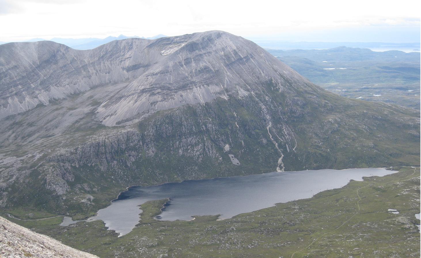
Hidden in the far North West of Scotland are these gems of mountains, modest in height but bold in every other sense. As if the mountains themselves aren't enough, the corries and glens around them are stunningly wild, and a network of trails penetrate the region offering lots of possibilities. The route described here is a summit traverse, but there is so much here that warrants another visit or two, and that's taking into account its isolated location! From the rocky summit ridges, the views over the rugged surroundings are very special, and on the right day stretch over the Minch to the Isle of Lewis. The traverse of these "Corbetts" is a fine, serious day's expedition on the mountains, but requires leaving bicycles at one end to get back to the car at the start (or if you're lucky like me, a helpful support-driver, just be prepared to buy them plenty pints and a dinner in return!) If using bikes I reckon leaving them at the NW end (Gualain House) as its mostly a downhill ride back to Loch Stack Lodge. And no, unlike most of my other entries, this isn't all runnable!


Blog
I wouldn't have attempted this on a poor weather day. Firstly it would be shame to miss out on the reason I was doing it - the views - but additionally I was out on my own (I didn't meet anyone else on Foinaven) and I'd read it could be quite easy for things to go wrong on a bad day. Looking back, I'm especially thinking about part of the ridge of Foinaven, which takes a bit of care when descending and I can imagine I'd have felt a little less "happy" had the rock been wet, the wind blowing hard, and the cloud obscuring an otherwise obvious route down.
From Loch Stack a really good (and cyclable) stalkers path takes one right into the middle of the Foinaven-Arkle country. As I jogged up this, Arkle was there somewhat intimidatingly ahead. The track swings around its Western flank and climbs gently to a high-point, with Foinaven coming into view. That's when I struck SE on ever-steepening ground that looked rougher and boggier than it was. The hillside ahead looked impossibly steep, but it must have been an illusion because the large scree boulders were mostly stable and walkable (no I'm not running at this point!).
I was soon on the summit and took a moment to admire the view over to Foinaven, and of Arkles' other summit, before starting to run along a nice narrow ridge that reminded me a bit of the Carn Mor Dearg Arete as it arced around. Once on the lower summit I started heading SE again, picking the easiest route I could find through the boulders, and around to Lochan na Fabileige, which is perched on a ridge and looks like it might spill into the glen below on a really windy day!
From there it was a rough descent ENE into a peat hags (I probably could have taken a better line sticking to the rocky slabs just to my SE) beyond which I picked up another brilliant landy track. I ran up this and onto the featureless grassy shoulder of Foinaven at Bealach Horn. The views back to Arkle were great, with its folds of bare rock. I returned to a walk now, drawn naturally to the crest of the SSW ridge so I was looking across Coir' a' Chruitier to my eventual onward route over Foinaven - but first I had to circle around the Coire.
Once this was done, and on the 808m peak, the true character of Foinaven was presented, and it started with a steep rocky descent that thankfully looked trickier than it was. Further down was the true test of the day - again everything's fine on a nice day and you take your time. The situation at this point is fantastic, with Foinaven's ridge rising impressively infront and behind, the view of Arkle across the loch directly below, and in the other direction, another ridge of this complex mountain, A' Cheir Ghorm (supposed to be a great ascent route too!) with its wall of orange scree running inwards to join the ridge ahead.
Continuing along the ridge, bypassing the impressive tower of rock, the route is more straightforward and views of the ocean open up again.

I visited both summits of Ganu Mor then my chosen route ignores the final peak to go exploring one of the many corries - Coire Duail. Before descending NE I managed to make radio contact (walkie-talkies!) with my dad who had just parked up at Gaulin House and was going to start making his way up the new landy road into the valley below. It's always a relief to make that first contact!

Traces of path can be seen on the scree ridge heading down, and once onto the wild craggy ground above the E wall of the Coire, there are the odd traces of boggy path again where deer and walkers have been funneled between the outcrops. I picked up the course of the burn that marks an easy way down N into the Coire and its Lochan, taking a last glance at A Cheir Ghorm behind me, and noting the vivid contrast between where I was now and where I'd been.
I put myself on the N side of the burn as soon as feasible and cut the corner slightly lower down to reach the Allt Coire Duail. It wasn't obvious where to cross the fast-flowing water but as I headed a little downstream there was an obvious safe place to jump the big rocks and so I attained a bit of a path on the N bank. When this petered out I just cut across country NNE out of the jaws of the Corrie and picked up the landy track which was followed for 4 miles up to the road, during which I met 2 of the only 4 walkers I'd encountered today. Having lost a bit of fitness lately I didn't have the endurance to run this, so it was a power-walk, but I was so happy with my day I didn't mind it. We got back to Durness campsite which had been home for the last couple of days and was home for the next couple of days. A fantastic area to spend a long weekend camping and exploring.