A runners perspective


I hope this blog is of use/interest to walkers, runners and cyclists living in or intending to visit Scotland. Most of my entries below are described as long-distance runs - just because that's currently what I enjoy doing...
Showing posts with label central highlands. Show all posts

Saturday, 3 August 2013

Above and Through the Lairig Ghru

Distance: 33 miles (53km) Ascent/Descent: 1860m/1860m 
Start/Finish: Linn o Dee (near Braemar) 
Terrain: 70% trail, 20% gravel/surfaced road, 10% Rocky Tundra (off trail) 
Transport: car  (or bus to Braemar & taxi)
Route: Route Map

Nice single-track by River Dee, Devil's Point behind, slopes of Bheinn Bhrotain to L
Summary
The Lairig Ghru is part of a classic 18 mile walk between Aviemore (Rothiemurchus) and Linn o Dee (Braemar).  The strange loop described here takes a high route Northwards on the mountains to the West of the Lairig Ghru, then returns back through the Lairig itself.  There are some interesting variations of this, e.g., a tour of the summits around Glen Geusachan, thereby including Carn Toul and the Devils Point.  When I set off I wasn't sure exactly what I'd end up doing, especially given the weather forecast.  The described route does provide two contrasting aspects of these mountains - they look a bit lame when seen from the rocky high ground to the W, whereas they rise impressively above cliffs and hanging corries.when viewed from the N or E.

Heading to White Bridge by the River Dee
Blog

The forecast wasn't great - reality check from met. office indicating rain, 70mph gusts and -5degC windchill on Cairngorm summits, a bit different from the 19degC and cloudless skies I was enjoying as I left work on Friday, walking through Edinburgh and watching festival-goers enjoying their beers outside the pubs.

Saturday morning in Braemar was dull but not that bad, the wind was still to pick-up and let's be honest 14degC isn't exactly bad for Scotland, just half what it was last time I was here.  


Might as well give the Cairngorms a try, I figured, if it got too nasty I could always come back down and do a low-level loop like Lairig Ghru followed by Lairig an Laoigh.  That appealed more than experiencing a Winter's day in August, being buffeted across a stony plateau which I could only see 50 yards of in any direction.  And it might clear up!  So we all tell ourselves.

Like two weekends ago, but in quite different weather, I left the car at Linn o Dee, this time heading W towards White Bridge where the Dee makes a right-angled turn.  I crossed this bridge and followed the river's E bank upstream, the wide track followed for the first 3 miles now left behind and replaced by a well-constructed singletrack that still had enough rocks on it to demand concentration.  I became aware I was already "in the zone", loving that feeling of heading off into the wilds again.  That's what the Cairngorms do best - they don't have the pointy shapes of the NW Highlands, but they do give a great feeling of "out there".  An intrepid mountain biker with a German accent (and probably a bruised arse) slowly bounced his bike over the stones towards me, he was also clearly buzzing with enthusiasm, already been up and down mountains and now on his way to bag the remote lumps of "Sgarsoch and Ealar" to the SW.  A reminder of how late it was - already afternoon.  Well I guess it gave the clag more time to b*gger off.


I followed the track until it does a U-bend to cross the Allt Garbh just beyond where title photo taken, then as the weather looked fine from down here I took a L fork to follow a seemingly newly constructed path that ascended the N bank of the Allt, this pretty much being my route up Beinn Bhrotain.  I was quickly reduced to a walk (back to UTMB training!) and the trail quickly reduced to a muddy strip through bashed knee-high heather, all a bit awkward, it quickly improves but I wasn't running again until above the waterfall higher up where the burn changes course.  Once on higher ground the path seems to disappear.  The clag was coming down the mountain-side now so time to reach for the map and compass (no pre-programmed garmin route today).  The jacket and gloves came on as the rain arrived, assisted by a sudden strengthening of wind.  Pretty bleak.  Nothing to see here.  I basically took a direct NW line towards the rocky dome of Beinn Bhrotain's main summit.  Terrain was runnable at first, wind-clipped grass and heather, but when I hit the gradient and barricades of rocks I gave up on the pretense of running and settled into a big stride that was probably faster anyway.  I arrived at the trig-point, sheleted by a fanatastic wall, so I quickly got myself low to the ground against this to escape the wind and consult the map.  And eat some more of those Jaffacake bars.  And flapjacks.  And wonder why the hell I had chosen to come up here and not stay down in the glens.  No regrets. 
A glimpse Glen Geusachan - sun shining somewhere!

From here it was pretty much a case of continuing on the NW bearing, which meant slightly traversing whilst descending, the rocks were pretty evil  (Derry Cairngorm was nothing in comparison), they were wet with ankle-hungry gaps between them, and the wind wasn't helping my balance.  I dropped down below the clag and could see a bit of the world again.  Just a bit, but enough to get me reaching for the camera in case I never saw anything else for the next while.  I could see the bealach below and a definite path emerge from it heading up towards Monadh Mor.  To my right I
A path emerges from the bealach towards Monadh Mor
could see down into Glen Geusachan - which looked like a pretty wild place to be.  It was a really steep way down from here but I judged it safe enough should I decide the need to escape the windy plateau!  For now though I was surprisingly cosy in the Haglofs LIM jacket, and keen to go on.  


A miserable sod descended out of the mist (so called because he didn't say hello or even acknowledge) and disappeared again below.  I climbed up towards where he'd come from, the path eventually disappearing but the terrain was much nicer and all runnable - it became all flat and featureless and cloaked in clag again so I had to keep an eye on the bearing ( NW till it starts to drop again then N).  

And so I unemphatically arrived at the cairn-topped lump called Monadh Mor.  And departed just as quick.

Harsh landscape of Moine Mor - Bhrotain & Monadh Mor in background
The cloud lifted and suddenly I could see for miles, there were splashes of sunshine on distant hillsides.  It was quite featureless to the W - the Moine Mor - I preferred looking E over Geusachan.  I found some inadequate shelter from a band of rocks and sat to eat and take photographs of this strange place.  Ahead near the watershed was a lochan, beyond which rose the slopes leading to Cairn Toul, Angel's Peak and Braeraich.  And a spring to take water from.  Three of the highest summits in Britain not looking so exciting from this remote, elevated angle - their much more celebrated corries and precipices hidden from view. It was good to see this contrast during today's run.  

After descending to the watershed, trying to decide where to go next, I again looked across the Moine Mor, rolling for miles towards Sgor Gaoth etc, wondering if there were any other dafties getting buffeted around up here.

In the end I admitted to myself once again that I like bagging Munros - worse still - bagging Munros that I haven't already done!  Carn Toul and the Devil's Point I'd done years ago as a student, the days when there were 273 Munros and Sgor an Lochain Uaine wasn't one of them.  The latter would eventually be my next target (sometimes called Angel's Peak), there was no Angel up there today, just wind and clag again.  As I ascended from the SW on increasingly rocky, pathless tundra (which was easy enough going) I started to see other walkers on the "main ridge" - more of a wedge than a ridge - gentle from my direction, cliffs on the other.  I eventually gained the path the walkers had been on, and headed ENE through the rocks, back into cloud, it was like the edge of the world to my left, and the wedge had narrowed into a ridge up here when I reached the small summit area.  I immediately dropped down as safely as I could to the lee side, which meant my feet were dangling over an abyss of cloud whilst I ate a roll and packet of crisps.

Retracing my steps down the path, I headed for Braeriach, certainly the highlight of the day for me.  Perhaps because by the time I'd hauled myself onto its rocky plateau (Carn na Criche), the clag had been dispersed and the more impressive aspect of Sgor an Lochain Uaine and Cairn Toul was on display.  I ran across the plateau assisted by the wind, crossing the river Dee again, this time no need for a bridge, a single leap was enough (the Wells of Dee were about 400m to my left), and climbed up through the stones back towards the crest of Garbh Coire, then finally NE for 300m to the summit.  Wow.

Looking over the Lairig Ghru from near the summit of Braeriach, Lochan Uaine beneath Cairn Toul
I'd certainly left the best for last.  Descending E and very quickly I was on a nice rocky ridge from which I could look down and across both sides.  Aviemore not far away, the world looking rather civilised over there in contrast to the other direction!  I was heading along the path marked on the OS map which descends 3 miles over Sron na Lairige.  Path improvements were taking place on the steeper, lower slopes.  As I dropped down, there was more and more sunshine and by the time I arrived at the Lairig Ghru beneath Lurcher's Crag it was Summer once again.  Jacket off, hat off, gloves off.  Now to finally tick-off another thing I'd always wanted to do - actually go through the Lairig Ghru.  

Lairig Ghru
And into the wind.  The Lairig Ghru is runnable, to a point, then its boulders.  Its also very beautiful (on an evening like this) and so I hardly minded the enforced slow-down, trying to ignore the fact I might miss my dinner back down at the Fife Arms Hotel!


Currour Bothy puts the Devil in perspective
I saw other walkers/climbers hanging-out at Corrour Bothy - a building dwarfed by the Devil's Point which in turn was dwarfed by its higher neighbours.  What a great evening for sleeping out wild.  At this point I reflected on my thought's about how the Cairngorm's don't really do "pointy and rugged" - from this angle the Devil's Point does a reasonable impersonation of the Buachaille!

I took the uphill L fork away from the River Dee to head for Glen Lui and eventually Glen Derry.  27 miles done and feeling good, the trail improving, and so I started to really run, like old times, taking risks now I was off the hill and seeing others about.  And sure enough I clipped a rock and became airbourne, this was going to be a nasty one, stupid boy.  God knows how but I
Looking N up Glen Lui from Lairig Ghru Path
managed to get my other foot beneath me, immediately clip another rock, repeat, regain control and continue forward.  What a recovery.  I went back into conservative mode after that, feeling very lucky.  Sure enough a through-packer came past me the other direction just moments later.  Back down to Caledonian Pines with the River Lui meandering through them, another highlight of the day, more people with their tents around Derry Lodge where I crossed the footbridge in the opposite direction to 2 weeks ago, and then a 3 mile easy run back to the car at Linn o Dee.  And yes I made it in time for dinner, by about 10 minutes.  Another great day.


Glen Geusachan, enclosed by Beinn Bhrotain (L) and Monadh Mor (M), Devils Point (R)

Saturday, 27 July 2013

Lawers Group

Distance: 19.7 miles (32km) 
Ascent/Descent: 2250m/2250m 
Start/Finish: C.P. N of Lochan nan Lairige 594416  
Terrain: 80% good tracks, 15% Road, 5% grass (wee bit of bog but not bad)
Transport: car for sure
Route: Route Map
 
(L to R) Ben Lawers, Beinn Glas, Meall Corranaich from Meall a' Choire Leith
Summary
Classic round of the Lawers Munros, walkable in a day.  My original route was to drop down into Glen Lyon (drop N from Meall Greig, follow tracks along S bank of R. Lyon and pick up access track up Glean Da Eig back towards start).  Instead, I opted for the longer (but less climbing) option so that I could maintain mobile-phone reception as it was getting late and there were storms brewing!

Blog
A late start, as this was a bit spontaneous.  I had planned on re-visiting the cairngorms this weekend having really enjoyed last weeekend, but the ongoing "stomach" problems prevented any thoughts of doing much over the last few days - it was already afternoon before I realised something might be on today...

Tarmachan Range from the slopes of Meall Chorranaich
The weather was perfect for the drive up, but forecast to deteriorate.  I decided to head to the Lawers area and try and get some desperately last-minute "UTMB" training in (hence hills rather than glens).  This year hadn't gone great running wise for reasons mentioned, so when I do get out I am all the more appreciative of having health, fitness and such fantastic countryside on the doorstep.


View NW, feat. Loch Lyon and Ben Nevis
After a bit of Lake-District-style parking somewhere around the tiny car park beneath the cairn (594416), I was jogging up a well-engineered track NE, the sun beaming down, the sky full of fluffy clouds, for now anyway.  It was already after 2pm so the majority of folks were coming the other way, having already earned their pints or whatever.  The path stops at bog, but it is a downhill bog so that's okay, I was aiming for the burn (Allt Geann Da' Eig) and then drier, steeper grassy hillside beyond it.  A feint path emerges beyond the burn and ascends around the corner of Coire Gorm, crossing its smaller burn (water bottle refill already!) before taking an uncompromising line up the steepening side of Meall a Choire Leith.  I stupidly tried to run all the way from car to summit (not clever UTMB training), so when I got to the top I was burst, but buzzing on endorphins and really happy to be up in the hills again.

Lawers & Ghlas, from start of descent off Meall Chorranaich
From then on the gradients are much easier so the running was great!  In particular there's a nice path over to summit No. 2 of the day, Meall Corranaich, with fine views of the next summits on the list, and also far-reaching views to the N horizon, Ben Nevis particularly prominent. 
About 100 or more deer ran in front of me as I ascended!  (Worth pointing out that the path passes by another fine spring for filling the water bottles).

The next bit was steeper, a sharp drop down beneath Beinn Ghlas - as you descend to the bealach ignore the gently-ascending "good" track that crosses between the mountains and look for the much fainter, steeper trail continuing up onto the NW ridge of the Beinn - it keeps South of the rockier bits and curves onto its crest via a grassy slope.  I of course missed this and ended up crawling up from the NW on all-fours. 

Once on top of Beinn Ghlas I was almost grateful to join the motorway up to Ben Lawers - another great trail run.  The ridge swings N immediately from the summit of Lawers, and suddenly things look a bit wilder.  Less people.  More rocks.  But a perfectly good and less ugly track descends down the ridge, steepening as it approaches the base of An Stuc (descend the bealach slightly N to get another stream for filling the bottles).


An Stuc above Lochan nan Cat

The ascent up An Stuc is initially steep but it levels off again towards the top. A fine place to be.
Now I've never been particularly confident with heights, but I seem to be getting softer with age.  I don't get any thrill out of being in exposed places, quite the opposite, so when I started the descent off An Stuc's E ridge and found myself above wet, slightly mossy slab of rock with a 30ft drop if I screwed up, I was actually pleased with myself for accepting my limitations and turning around.  Maybe okay for ascending but not descending, certainly not by me anyway!  Especially since vertigo is listed as a possible side-effect of the medication I've been put on! When I got back to the top I spotted that I'd come off the main path (which swings to the S and takes a much easier line).  This I was much happier on, it wasn't so much a scramble as a bloody steep path requiring lots of care (and testing loose rocks before putting weight on them).  I personally wouldn't go near here in Winter.
View down into Glen Lyon

The rain had started briefly, I knew it was coming, but I could still see most of Northern Scotland basking in sunshine.  The South was getting a soaking.

I continued over to the summit of Meall Garbh (a great view back over An Stuc and the Ben), steep in places, but from there to Meall Greig the mountainous feel evaporates into rolling grassy country-side, perhaps a bit of a drag to walk but it was a great place for a run!  A note left on the summit cairn brought a tear to my eye (definitely getting softer with age).  So that was that, seven Munros unceremoniously bagged (including one I hadn't done before - An Stuc weren't on the list when I were a lad!).
 
Lawers and An Stuc from Meall Garbh

As the sky started creating its own set of mountains in the form of storm clouds, and as it was quite late in the day, I decided against my original plan of dropping N into Glen Lyon.  A slight regret - it looks like a nice route (Glen Lyon is beautiful), and is actually shorter than what I ended up doing, although a bit more re-ascent required to get back to the car!  Because today had been a bit spontaneous, I hadn't really read up on the route through Glen Lyon (I'd planned this circuit a year or so ago and forgotten the details), and knew I wouldn't have phone signal down there, so stuck to the S aspect of the range instead.  

Meall Greig being threatened by the sky
  I dropped down to the tiny dam on slightly awkward tufty-grass, crossed the burn beneath the concrete sluice and attained the fantastic track on its W side.  This bit kind of made up for missing Glen Lyon - a chance to really run along this elevated smooth track above Loch Tay, with the Lawers summits rising above to the R.  It makes for really fast progress back towards the start, but there is a price to pay...

Loch Tay from the contouring track

After almost three miles of heavenly running, its important (I think) to take the feint upper-fork in the track, which ends abruptly above a defile.  I followed the fence-line on its far side, but there's no path and the terrain is quite rough going.  I was wary of losing too much height here, and aimed to remain above the lump marked on the map as Creag Dubh, which meant climbing slightly, and I was reduced to power-walking.  Once over Creag Dubh the contours turn more NW (into Corrie a' Chonnaidh), and I was finding traces of sheep-trod along the fence line here.  Eventually I was looking over the fenced-off deciduous plantation about 70m vertically below, and ignored the direct line down (involving climbing a deer fence and feeling naughty!) and continued to contour more N to pick up the main path down off Beinn Ghlas, which is all very civilised and uses a gate!  I was being soaked by thick drizzle by now, but grateful to be off the ridges and not exposed to thunder/hail storms - there'd been many of these lately.  From the N.T.S. car park it was a 3 mile uphill road-run back to the car sitting on its own at 8pm.

Saturday, 6 October 2012

Ryvoan Bothy Circuit

Distance: 27.3 miles (44km) Ascent/Descent: 420m/420m
Start/Finish: Choice of Aviemore, Boat of Garten, Nethy Bridge or Glenmore Lodge
Terrain: 85% easy gravel, 15% quiet road
Transport: train and citylink bus serve Aviemore.
Route:
map
An Lochan Uaine - between Ryvoan Bothy and Glenmore Lodge, Cairngorms


Summary
This route is so popular I feel like one of the last outdoors enthusiasts in Scotland to have done it! Lesley had cycled it many times before, a girl at work had also reccommended it, and during breakfast at our accommodation in Boat of Garten, our host went and suggested it too! Not that we were particularly in the mood for a "mission" after a late Friday evening in the Boat Hotel! I can now see why its such a favourite - rarely on road and passing through forest, mountains and moorland, yet mostly flat and easy going (just one or two brief parts that require care if on a bike). And there's some gems en-route such as "The Green Loch". In spite of all the endorsements there is only a short section of the route which felt "busy" this weekend. The views deeper into the Cairngorm wilderness really caught my imagination for future exploration.  

River Spey, near Nethy Bridge, Cairngorms behind

Blog
Low morning sun in Abernethy Forest

I've mentioned before that September/October is my favourite time in Scotland. Okay it was baltic, but we were lucky to wake up to blue skies, still air, frost on the ground. Boat of Garten was silent, the air tinted with woodsmoke. We extracted Lesley's bike from the boot of the car and quickly got moving East out of the village via the bridge over the alluring River Spey.

Lesley pedalled along the road whilst I jogged along the adjacent "Speyside Way". It was probably only once we'd escaped the road, empty though it was, and entered Abernethy Forest that we really started to enjoy this journey, the groggy too-many-beers-last-night feeling being replaced with how lucky we were to be here! The pine forest had the ubiquitous carpet of heather, blaeberry and an occasional ant-hill. Blue sky above, dew sparkling in the sunlight, birdsong accentuated by the stillness, and now we'd done a couple of miles the coldness was refreshing rather than bitter (like the Guinness at Aviemore later). We shunned the road-side route of the speyside way to take the loop through the trees, then picked the "way" back up as it parallelled a single-track road for a bit then headed East again towards the wee town of Nethy Bridge (shop).
Start of "rights of way" to Braemar/Glenmore
After a break at the picnic tables by the River Nethy, we followed the road up past nice river-side homes we wish we owned, eventually onto gravel and back into the forest.  It was starting to cloud over now as we pedalled/ran deeper into the woods, a very subtle gradient taking us up towards Forest Lodge and the RSPB nature area.

 There was a choice of routes and we accidentally took the higher one up to Rynettin Farm, which was worth the extra effort for the view across the moorland into the Cairngorms proper, the higher points of which now carrying a dusting of recent snow.  It was a bit of a surprise exiting the forest and passing by a field of cows - with boarded-up farm buildings above - having seemingly left civilisation a few miles ago. 
Descending from Rynettin


An Lochan Uain
From here we were entering the mountains, but never having to climb them - the track dropped down from the farm to join the easier route that we'd missed, then undulates along the moorland, flanking the Corbett "Meall a' Bhuachaille" (also a popular walk in its own right, with a manicured path up to its summit from Ryvoan Bothy - this area was the only "busy" part of our day!  There's a hill race up Meall a' Bhuachaille in October, although this shuns the manicured route and goes straight up the side!).
View from a rock, into the wild (Cairngorms)


The rain was coming down as we approached Ryvoan bothy, so we took shelter there and were soon joined by many others.  Lesley produced the hip-flask, obviously trying to slow me down!  She didn't need to worry as it was mostly downhill from here - although a bit of care is needed when cycling the immediate descent S from the bothy.  At the bottom of this hill is the beautiful An Lochan Uaine (Green Loch), so time for another stop.
The path was manicured gravel from here to Aviemore, and provided a nice alternative to the surprisingly busy Glenmore Lodge road.  We broke the journey at Aviemore (Guinness and food) and eventually got moving again for the final 5 miles along the speyside way (cyclepath) back to Boat of Garten.  The food was heavy in the belly but we weren't in a rush - this is another beautiful stretch of moorland with views over the cairngorms, just a shame the rain returned - very cold rain, arriving in squalls.  That's why I don't have a photo of this bit, but here's a blog with a stunning view of it:

http://westcoasthikers.wordpress.com/great-britain-2012/speyside-way/aviemore-to-boat-of-garten/


Saturday, 26 May 2012

Etive Peaks and Glen Kinglass

Distance: 27 miles (43km)  Ascent/Descent: 3050m/3050m 
Start/Finish: Victoria Bridge (Loch Tulla) 
Terrain: 55% hill trails, 15% pathless, 20% gravel track, 10% easy trail  
Transport: citylink bus stops at nearby Bridge of Orchy 
(Ft. William/Skye - Edinburgh/Glasgow services)
Route: Route Map
 
Looking North over Glen Etive towards the summits of Glen Coe

Summary
Today's run was less "Exploring Scottish Trails" and more "Obsessive-compulsive Munro Bagging" in the sun. Starting from Victoria Bridge (by Loch Tulla on the West Highland Way), it takes in the group of summits stretching between Rannoch Moor and Glen Etive, starting with Stob a Choire Odhar, eventually reaching Ben Starav beside the stunning Loch Etive, before returning via Beinn an Aigenan along Glen Kinglass to the start. This last bit is just part of a nice trail that runs West from Victoria Bridge (on the West Highland Way) to Loch Etive, where it meets another trail that runs North/South from Tayinult to Glen Etive. Forgetting summits, both these options offer nice scenery away from roads and towns - and would also make good mountain-bike trips (as evidenced by tyre tracks in the bog!).  

Blog
We parked at the gravel car park by Victoria Bridge – this is a popular camping area for those doing the West Highland Way or bagging Munros. When Lesley and I stepped out of the car the wave of heat that greeted us was very un-Scottish. The boggy ground by the road was dry and dusty. Lizards crossed the gravel path in front of me as I made my way Westwards along the stoney track into Glen Kinglass. Staying hydrated was going to be the main challenge for everyone today.

Good track up onto the ridge of Stob a Coire Odhair
 I followed the Munro-baggers route that forked N off the main track and gently up into the jaws of Coire Toaig on a path that made for very enjoyable running. My first summit, Stob a Choire Odhair, was hidden from view by the steepness of its heathery lower slopes. Immediately after crossing a river and stopping for a chat with a couple, enjoying a rest by the soothing sound of fast-flowing water, I forked right to take the Munro-baggers’ route, climbing steeply up eroded heathery hummocks by the river's NW bank. I was reduced to a walk until the gradient lessened and joined an old zig-zagging stalkers' path up towards the the stoney summit, a fine viewpoint over Rannoch Moor, in fact a fine viewpoint all around with the Black Mount to the N and to the W the mighty Stob Ghabhar.   That's where I was heading next.

After another brief chat I was heading down the not-too-steep W ridge of "Odhair", picking up a bit of a path down to the 668m pass, then continuing along the ridge ahead that curves more S and becomes rocky. Even though the path zig-zags a bit, I was still reduced to a walk on this stretch (something I need to practise anyway so I can survive the longer mountain events!).

Stob Ghabar
The lochan in Stob Ghabhar's NE corrie came into view below - an impressive setting. Having attained the crest of the mountain's SE ridge, it was an invigorating run up to the summit cairn where I was labelled "a nutter", and instructed to "make sure to drink plenty water".  I guess she figured anyone stupid enough to run up Munros is likely to need all the advice they get.

From here onwards I was covering unfamiliar ground.  That's the bit of a run I always enjoy most!  Descending slightly N of W along a broad, grassy ridge, I felt (and knew) I was leaving the crowds behind and entering lesser travelled territory for a few miles.  The views from this elevated platform were particularly good, especially North over the Buachaille Etive Mor and Ben Nevis above and beyond.

Ben Nevis standing high above the Buachaille
I had to drop down a bit to get fresh water for the bottles before traversing increasingly awkwardly back onto the ridge (much easier to stick to the crest!). Meall nan Eun looked diminutive from up here, and yet it was a long loop to the N before I could get onto its slopes from a bealach down at 633m! Descending to this needs a bit of care with a couple of crags needing "turned", so a bit of zig-zagging required before I got safelt down, picking my route onwards onto Munro 3 of the day. There's a fairly obvious grassy terrace to aim for (in good visibility) a couple hundred metres to the W of the old boundary wall, so I aimed for a gap in the outcrops where a burn flows down (186 458), finding evidence that this is where other walkers (and/or deer) head for.
Stob Coir a' Albannaich above the bealach before Meall nan Eun
Up onto the terrace, now just walking, its possible to start heading more SE through the gentler outcrops and attain the runnable plateau in search of the summit cairn, which even on this clear day was a bit shy! Its a 4.5mile mountain run from Stob Ghabhar to this summit, and being less-travelled I'd enjoyed having it all to myself. This was probably as remote as the route would get. From the small cairn I was almost doubling back on myself (NW) over the tundra to eventually continue W via Meall Tarsuinn - finding myself a good path upon its crest and down to the bealach beyond, with "Peak of the corrie of Scotsmen" ahead of me, Munro No. 4, and once again I was seeing others out enjoying this ridiculously fine day. Although hot down in the glens, the warmth was pleasantly temperate up here on the ridges. Everyone was wearing their brimmed hats.

From the bealach, Stob Coir an Albannaich’s rounded summit is attained via its ESE ridge (very much following the boundary on the map). The route onto this ridge is basically a gently-angled series of slabs with traces of path to the E of an obvious gully. Once onto the ridge it was again very runnable to the summit, where I became aware how close I now was to Glen Etive, its partly-forested base nestled amongst the array of fairly sharp peaks south of Glen Coe.

Glas Beinn Mor
Onwards to Glas Beinn Mhor was great fun - starting with a gently sloping area of high tussock grass over which I headed SW, then more SE as soon as it steepened to keep on the crest. Again basically following the line of the boundary marked on the map. Much easier on a clear day like today, I was eventually picking up traces of path, zig-zagging more steeply down to the 738m bealach beneath Glas Beinn Mor where a very well-todden trail starts the final climb to the summit. A bit of walking and then running to the top, and I was now looking directly across to the mightly-looking Ben Starav! The ridge up Ben Starav has plenty character, climaxing with a bouldery arete (bypass path if required) running between the pyramidal Stob Coire Dheirg and Starav’s SE top, from which one of the nicest mountain views in Scotland is to be had, with Loch Etive down below and the Atlantic Ocean beyond, Mull and Ben More looking not too far away at all.

Stob Coire Dearg, with the SE top of Ben Starav behind
 It was much busier over these latter mountains – lots of people making the most of the weather. But it would soon get quiet again once I’d retraced my steps back down to the Bealach and taken a path SE from there, dropping from the main ridge and aiming for the final Munro of the day – Beinn nan Aighenan.
Loch Etive from Ben Starav (Ben Cruachan visible top left)

It turns out there’s a path nearly all the way from the bealach to the top, although it does peter out in a couple of places. It’s a fairly isolated Munro, but there are still fine views over Loch Etive with the Cruachan range not too distant ahead.
 
Looking N to Meall nan Eun over Loch Dochard

A last glance behind up the Glen, near Victoria Bridge
Dehydration was setting in – there’d been very little opportunity to fill the bottles without descending too much off the ridge. As a result my legs were sluggish and my day quickly became more “endurance” and less “enjoyment”. Well I suppose I am in training after all. The worst problem was how long it was going to take me to get down off the Beinn’s slabby, twisting E ridge to a burn to refill the bottles! I don’t recommend my route choice here as the terminus of this ridge is rather steep over a succession of slabs. Taking this E ridge is fine so long as you don’t try and “cut the corner” for the bridge down in Glen Kinglass like I did – and instead stick to the crest as it swings S for a few hundred metres, before beginning to descend.

With hindsight I think I’d have been better just heading SE off the summit into Coire a’ Bhinnein where there’s water, and also a path marked on the 1:25000 map.

When I eventually did get the opportunity to rehydrate, life slowly came back to the legs and I could enjoy running down the glen with the evening sun, still very warm, hitting the hills I’d visited the tops of earlier. I particularly liked the view of Meall nan Eun across the loch, now looking up at it rather than down from it.

The path joins a dirt track then leaves it again (crossing a dodgy suspension bridge to the N bank of the river), making its peaty way back towards my outward route this morning, then eventually the car at Victoria Bridge.

Saturday, 24 March 2012

The Great Glen Way

Distance: 73 miles (117.5km) Ascent/Descent: 1350m/1340m
Start/Finish: Fort William to Inverness
Terrain: Easy throughout
Transport: Train stations at start/end. Citylink bus serves the Great Glen
Route: Map 1 Map 2


Summary
The Great Glen Way is not remote, the route is very well marked and generally low-level with long flat sections by lochs or along towpaths, but there are two or three sustained climbs of note along Loch Ness. There's plenty info online. If I wasn't so much into trail-running I think my mode of choice would be mountain-bike. Or how about the recently added option: Canoe?

Blog
At 5:25am it was still dark. The air was mild for March and perfectly still. Fort William would have been peaceful had it not been for the bloody seagulls.

My dad and I carried the bags from the hotel to the car, and before parting ways we briefly confirmed our agreed "schedule" (still hate that word). The Premier Inn was handy for the Great Glen Way, the start of which I eventually found and so began the long day's journey to Inverness.

On my left was the estuarine mouth of the river Lochy, although I couldn't really see it. On my right the industrial estate gave way to houses and I followed the blue thistle way-markers through them, before being routed off the pavement into some trees. It was good to get away from the road and the orange glow of street-lamps. I followed the beam of the headtorch across rough grassland alongside the river, and began to feel excited about the journey ahead.

I'd had the "Great Glen Way" in mind as a good low-altitude option for this Winter, but it hadn't happened due to a fairly busy racing calendar. I guess that could explain why today my legs felt so sluggish from the outset, but this wasn't a problem, in retrospect I've concluded the enforced slow-pace helped ensure the day's success.

A wooden footbridge took me over the river and back into street-lights, and so the headtorches work was already finished for the day! There was enough daylight entering the sky to outline the summit of Ben Nevis, and by the time I'd run through Caol along the shore of Loch Linnhe to the mouth of the Caledonian Canal, I could see my way no problem.

The way follows the canal's towpath for the next 8 miles. At the bottom of the series of canal locks known as Neptunes Staircase, my dad was standing waiting for better daylight so he could hunt his first geocache of the day.

The hazy day continued to dawn as I jogged alongside the wide mirror-like canal North East. The housing estates were left behind and the hillsides of the Great Glen began to rise up. Ben Nevis with its small patches of snow was still visible over my right shoulder – this really has been a mild Winter. The impressive River Lochy was also on my right, at first it was below the tall embankment of the canal but after a few miles the canal and river came side-by-side with just a concrete sluice separating them. Although pretty, I do find canal towpaths a bit monotonous and was glad to be running rather than walking. It is however a fine place for a bike, and an even better place for a kayak and canoe. Incidentally the Great Glen “canoe trail” was being opened this very weekend!

As planned, my dad was waiting at the picnic area by Gairlochy locks, just 10.5miles into the run. We both commented on the fact it was nice not to be in a race, able to take our time, have a chat, enjoy a bit of a picnic. The weather was playing along nicely. The slower pace meant my stomach could handle whatever, and so at Gairlochy I was enjoying a cafetiere-made filter coffee.

We discussed our next meet-up at “Laggan Locks” another 12 miles up the glen, then I set off just as slowly as I arrived, firstly crossing to the other bank of the canal and following the road North uphill. This next section would take me along the NW shore of Loch Lochy – with Laggan Locks being at the head of the loch.


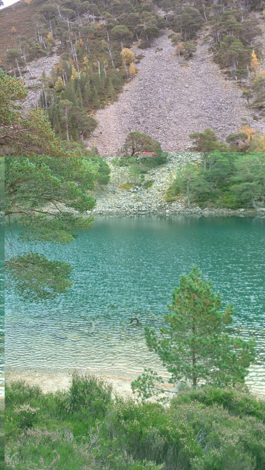
One of the blue thistle marker-posts directed me off into the trees along a nice gravel single-track path – here followed one of the nicer sections of the way as the path wound through the pines, re-crossed the road then dropped alongside the glassy expanse of Loch Lochy. All the colours were muted with haze and the loch merged seamlessly into the sky. I was reminded a little of the Loch Lomond section of the West Highland Way, but without the crowds, in fact I saw the first Great Glen walker of the day here, who’d obviously camped solo on the shore and was packing up his gear ready to set off. With no houses or roads in sight he’d sure found a cracker of a place to camp.

The trail did re-join the “B-road” and almost immediately a car came along to breach the peace! And then another, and a few more including a forestry van. I realised they were probably on their way to work at the logging area up the loch where I’d read a diversion was “in operation” for walkers (and not suitable for cyclists – which I can totally confirm!).

In spite of the tarmac and light traffic it was still nice scenery, the pines now replaced by birch and bracken. After passing some big houses and crossing the river Arkaig the way leaves the road at Clunes and follows a wide forest track along the steep forested slopes (yes, back to pines!). Here the Great Glen is at its deepest, with two “Munros” hidden from view somewhere above the trees. This was the first time I’d travelled up the glen on the remote N side of the loch - every other time I’ve been in a car along the A82, which unfortunately was still audible across the water. The Great Glen Way is hardly remote – but this section is probably as close as it gets, on the left of me it was just wild country all the way to the equally wild coast.

I said hello to two more walkers along this forest road, and a forest worker, then reached a red/white striped tape across the path and an arrow directing me to the start of the temporary (I hope) diversion.

The diversion was a bit of a monster! Straight up the mossy, twiggy steep side of the forest. The route was marked by both tape and skid marks where victims had slid through the moss on their boots and arse. I power-walked up the diversion and it was over in 10 minutes, with the bonus that I was now 150m higher above the loch with views over the harvested forest, across the glen, and with a fast runnable descent along a dirt road to enjoy.
A couple of miles later at the end of the loch I was reunited with the Caledonian Canal where it enters the loch at Laggan. My dad was already set-up in the picnic area beyond, the stove having been put to good use as there was French onion soup and more filter coffee waiting. Nice.

The next part was what I’d been looking forward to most – 8.5miles from Laggan Locks to Fort Augustus with 4 miles along the “remote” side of the narrow Loch Oich. Even next to the A82 road this is a fine part of the route. At first the way follows more towpath, and “the Avenue” – a nice gravel path through trees, then it crosses the A82 around the back of the “Great Glen Holiday Park” on an access road over the marshy watershed of the glen. Ironically it was downhill to Inverness from here along the canal, but uphill (then down) a few times along the way.

Now following the course of an old railway line, I noticed the remains of a station platform beneath grass and trees. An adjacent interpretation board showed a picture of how this station looked back in 1938 when in use! There are a lot of these tall blue pillars with pictures and text along the Great Glen Way, which is good news for those walking the route, although maybe it would make reading the “guide book” redundant! I personally like to read up on established routes before running them, and especially enjoy other people’s journals/blogs as I get more out of the journey (both before and during).

After taking in Loch Oich and having a last glance South back over its glassy water (title photo) it was onwards past Bridge of Oich where were a group were gathered and preparing for a paddle - the Great Glen Canoe Trail was formally opening today.

After visiting the pretty canal locks of Cullochy and Kytra I arrived at Fort Augustus - passing the now tired-looking Chalet Park where I'd spent my October holiday as a child (and remember wishing my dad would take me up the forested hill with the trig point behind - well I guess he's now making up for not doing so!)

Marmite Crisps were going down a treat - not your typical runner's food but like most ultra runners say its just a case of eating whatever works at the time. A banana (a bit less unusual I guess) was also had. And another filter coffee, which unfortunately is a diuretic. But tasted great. We had a fair break here, I mentioned only 39 miles to go and my dad said "What!?". Even I kind of felt Fort Augustus was half-way, and having now completed the route it still feels like it was half-way, but in terms of both distance and climbing effort it was far short.
It was a bit more difficult to get moving this time after the long break, but the break was worth it for both me and my dad's sake (its not a race!) and a sharp uphill back into forest soon sorted me out. I saw my third and penultimate group of fellow "wayers" here, older chaps with sticks and backpacks, and looking like they were already thinking about their next pint (and if I'd been with them they'd have just finished one before leaving town). The sun was cheering the glen up now, and warming the air quickly. After climbing a little up the side of the glen, a nice view opened out over the head of Loch Ness.

The forest track contoured around the hillside and dog-legging before dropping down into Invermoriston - which I think my dad & I agreed was one of the highlights of the day. Just a nice wee place. Maybe the sunshine helped, but we both enjoyed relaxing at a picnic table by the highland coos, Telford's old stone bridge and the inviting-looking Inn within view. It was also nice to hear from back home where Lesley had run a good time at her first "Park-run".
I'd warned my dad about how I might be feeling during the next bit - a long (14 mile) hilly stint to Drumnadrochit on legs that had already covered over 40 miles. I felt confident enough to text my mate Sandy who lives nearby and let him know I should be there sometime after 3pm if he was still keen and able to meet up.
I gained even more confidence as I hit the steep hillside and found some hidden energy from somewhere - in fact my garmin claimed I'd done a 9-min-mile up this so it wasn't imagined. I'd only just told my dad the key to cracking this next bit (for both of us) was "patience". I had to remind myself this a few times but knew I had a stupid care-free smile on my face, having a "high". I really don't take fitness and health for granted and as corny as it sounds I'm finding at times the trail-running feels like some kind of "celebration of life". Or perhaps those are just the lame words of an endorphin junkie.

Back on Planet Earth there was a long switch-back forest road with a runner on it making his way up to a collection of buildings called Grotaig. The forest track ended and some fun rocky single-track continued downhill then back up, quite steeply, eventually arriving at the aforementioned place where a road terminated with car park. A black Landrover was moving slowly towards me.
It was Sandy! His son David was sitting shyly in the back. We chatted briefly, he'd received my "text" and headed down here to meet-up. He said I was looking well (I had warned him I might have dropped-out before reaching here) and I let him know I did indeed feel fine, understandably tired but still enjoying my day. Originally he'd wanted to run a leg of this journey with me but bad timing on my part denied us. He was still keen to meet back up at Arbriachan Forest (a few miles North of Drum) and so I was soon on may way again, following tarmac on high moorland, taking time to look back at the fine profile of the "corbett" Meall Fuar-Mhonaidh, which I've still yet to climb (perhaps with Sandy one day?).
By the time I arrived at Drumnadrochit I was paying for the speed and the run had become more shuffle-like as I cut across the town car park towards my dad and the ubiquitous picnic table. I was now into the inevitable "countdown" mindset - 18 miles to Inverness (which after 55 miles takes a bit longer than a marathon-training run, and also involved a 360m ascent to the highest point of the way)! Dad mentioned later he could see I was having to psyche myself to get going again. The hardest part was actually taking the jacket back off as it was getting cool sitting around in spite of the sun.
And so ensued a pavement shuffle along the A82 for a mile or two, and the sweat was pouring off again (a good thing!). The trail climbed up above fields away from the noisy road, and I found myself struggling to open and close a plethora of gates. At one of them I stopped for a photo-breather looking back over the loch towards Urquhart Castle.

Back into forest, I knew I was upon the final dreaded climb. I was still able to run most of it as the gradient wasn't too bad, just a couple of short steep pulls lower down. This was the most varied part of the route, I felt, going from loch-side town to fields, then forest, then out onto moorland above the glen. I knew about the "Highest Point of the Way" post from others' reports, and was looking forward to seeing it. I wanted to give it a hug.
I was now in the Abriachan Community Woodland and I can't highlight enough how valuable this place is to walkers on the Great Glen who wish to break up the long 18mile stretch between Inverness and Drum - there's a campsite and a cafe here, and its a really cool place so take note!
Sandy met me as I descended the forest track towards the road, he put David on his shoulders and ran alongside (quite impressive - and David was loving it!). He reminded me it was mostly downhill to Inverness from here, and was going to meet me for a pint there later. Fantastic!
The pint was going to taste amazing after all this. It was only another mile before I met my dad on the single-track-road that would form the route of the Way for the next 3 miles. He'd found a parking space (and a couple of geocaches). And he was so obviously as knackered as me. We'd both been up since silly-o-clock. After more (mmm) marmite crisps and full-fat coke I set about completing the last 11 miles of the journey. I knew that by this stage the idea of running on easy tarmac would be welcome rather than boring, and so it was I logged my fastest miles of the day, now wearing my dad's day-glow yellow top as the sun was now very low. I was surprised to get routed off the road by a waymarker post well before Blackford (obviously a new addition since my map). Then it was an easy run down into Inverness through heather-carpeted forest on a trail that reminded me of Rothiemurchus (Cairngorms).

I got my first glimpse of Inverness from behind a pond. My mobile rang - stopped, then started again. It was Sandy, trying to locate me so we could run the last wee bit of the route after all! We met about two miles from the finish - I'd just descended through the grounds of a Victorian Mental Hospital where they probably would have locked up ultra-runners (particularly vegetarian ones) but fortunately the world is more tolerant these days. After the last stretch of canal for today (running in the direction of Ft. William I might add!) we joined the Inverness half-marathon route beside the running track and stadium - Sandy had just run his PB there two weeks before, and so I bored him with stories of all the PBs I'd run in Inverness and how the track rekindled great memories for me.
We also passed the tree beside the start line where usually in March all the runners huddle together for shelter as bare arms, legs and faces are battered by strong winds and sleet. Timing had been perfect in terms of daylight - we ran over a multi-coloured lit suspension bridge and through the fairly-lights (which Sandy hates) on the island where the outdoor theatre is, then on the final home stretch to the castle. My dad stood shivering. He'd quite rightly already had a couple of pints in the Castle Tavern nearby. After the customary finish photo by the Great Glen Way post, it was time for some beer. The barmaid was a star, seeing me shivering in my inapropriate-for-pub running gear she grabbed a couple of blankets for me. Another cracker of a weekend had - thanks to Sandy and my dad for their support (Sandy had supported my West Highland Way race in 2009).