A runners perspective


I hope this blog is of use/interest to walkers, runners and cyclists living in or intending to visit Scotland. Most of my entries below are described as long-distance runs - just because that's currently what I enjoy doing...
Showing posts with label blair atholl. Show all posts

Saturday, 11 August 2012

Glen Tilt and Beinn a' Ghlo

Distance: 23.5 miles (38.5km) 
Ascent/Descent: 1670m/1670m 
Start/Finish: Blair Atholl  
Terrain: 45% gravel, 40% Hill tracks, 15% road.  
Remote moorland but generally dry/firm underfoot
Transport: train station and citylink bus services Blair Atholl
Route: Route Map

Lower Glen Tilt

Summary
Glen Tilt is bicycle-heaven.  It forms a great through-route from Blair Atholl to Deeside which I used many years ago as a student when cycling from Fife to Aberdeen!  It also makes for easy walking/running acess into (or out of) stunning remote country.  Next to Glen Tilt but generally hidden from view are the broad rounded heather-clad lumps of Beinn a' Ghlo, which boasts three Munros.  This route takes in the summits of the Beinn first, then gives the tired legs an easy trot back down Glen Tilt.  Once onto the first summit of Carn Liath, the gradients are generally gentle and the cols are shallow which makes it all very runnable. There are great views over high moorland to the Cairngorms, but my favourite view is from the descent down into Glen Tilt.

Blog
With less than 2 weeks until the Grand Raid des Pyrenees, and only 2 weeks since enjoying a fantastic run at the Lakeland 100 race, I chose this run as a way of keeping the fitness ticking over, hoping not to do any damage to muscles that were still in recovery mode.  (My original plan for this loop was to return via Carn a' Chlamain - a Munro on the NW side of the Glen.  This adds 4 miles and 650m ascent.)

Memorial Stone - Carn Liath rising beyond
There's parking in Blair Atholl opposite the entrance to the Caravan Park, with shops nearby.  That's where I started from, going through the Caravan Park and along forest track to the Glen Tilt Car Park (an option to shorten the run a bit!).

Beyond the old bridge over the River Tilt, a single-track road leads E up to Loch Moraig, making relatively easy work of the first 200m of today's ascent.  (There's a small car park up here - full by the time I was jogging past after midday).

A gravel track branches off to the NE, the gradient remaining gentle, then after a mile of this it was time to start climbing proper, forking N over a small crest, past a couple of huts, and once through one of the only areas of bog I'd encounter today.

Braigh Coire Chruinn-bhalgain (1070m),
with Carn nan Gabhar to R (1129m)
It was an enjoyable climb up Carn Liath, a climb that gets steeper with height, where the trail became loose gravel.  Zig-zags helped me keep a gentle upwards shuffle going.  I should really be practising 'power-walking' up hills but the shuffling feels easier on fresh legs.  I think.  Fast low cloud clipped the summit above, and sure enough once out of the shelter and onto the final gentler rise to the summit cairn it was time to put the jacket on and cut out that windchill!  From here, the running is much easier and there is a rough path to follow.  Beinn a' Ghlo is higher than much of the surrounding countryside so on the right day its a great viewing platform.  The ridge snakes downwards a bit from here, first heading NW, then NE over a lump, then N down to a bealach where there's an opportunity to fill water bottles without losing much height here if you contour N for 300m. 

Some more "snaking" E then N along increasingly rocky and broadening ridge before the next summit is reached.  Already there's only one significant climb left for the day, which suited my still-recovering legs just fine!  The cloud lifted again and I could see far into the remote country to the NE - basking in sunshine - with the Cairngorms clearly visible beyond.

Looking from Airgoid Beinn SW back over Carn Liath
I took in the top of Airgiod Beinn (view above) before climbing the final Munro of the day, Carn nan Gabhar. 

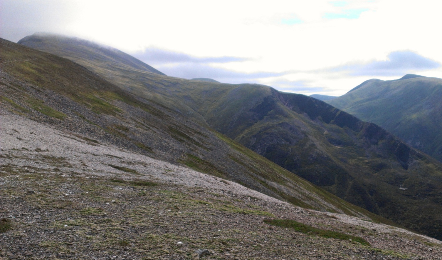
Looking back S towards Carn nan Gabhar
Now followed 2.5 miles of easy downhill running along the N continuation of Beinn a' Ghlo, then NW over Meall a' Mhuirich (898m) following traces of path.

The sun was really shining, the jacket was off again, a feeling of being on-top-of-the-world, happy days!

Descending through the heather towards the beautiful Glen Tilt
Dail Feannach above Glen Tilt
Dropping down into Glen Tilt requires a bit of care - its very steep, the heather is tall, but there is what I assume to be an old and little-used stalkers' path which is well worth finding as it zig-zags safely downwards.  (Don't be tempted to drop down towards Dail Feannach like I did - just stay on the direct line for Glen Tilt, aiming for the footbridge as soon as you see it, and you're very likely to find the path I refer to).

Looking down Glen Tilt, 9 downhill miles to go!
A great place to fill the bottles


After enjoying the sunshine for a moment, sitting by the cascade and re-filling the bottles, it was time to pick up the pace down the easy track. The sunshine was such a bonus - it hadn't been forecast! And it was very warm too.  There were a few mountain-bikes chained to fences along the glen, which makes a lot of sense for exploring the hills around here.

With only 4 miles to go the glen begins to twist and drop a little steeper.  There is a final short rise to overcome before arriving at the Old Bridge of Tilt, from where the route rejoins the first outward mile.  A great accessible day out.


Saturday, 7 August 2010

The Minigaig Pass

Distance: 29.5 miles (47.5km) Ascent/Descent: 1160m/1260m
Start/Finish: Kingussie to Blair Atholl
Terrain: 70% gravel/surfaced road, 30% Remote moorland, bog, sometimes pathless
Transport: train stations at start/end. citylink bus services both places
Route: Route Map | Garmin Course


Summary
This route isn't dramatic by any means, but would appeal to those who seek wild, remote country, and a bit of a challenge of course. If running, forget about it until Summer/Autumn. I've read that in Winter it is a much more serious undertaking as the 880m pass is likely to be deep under snow. Even in Summer, there isn't much evidence left that this once served as the main route North to Inverness! The route crosses high featureless (and somewhat pathless) moorland which I'd imagine is probably more often in cloud than not, so navigation skills essential.

Blog
Forecast was for the low cloud to gradually clear during the day, and a freshening N wind - perfect. I drove up to Blair Atholl station, bought some supplies at the wee shop then sat in the sun waiting for the train, really excited about the day ahead. Disembarked the train at Kingussie and started running immediately E away from town and past the Ruthven Barracks along a road. The road was quiet, but it was still nice to escape the tarmac via a gate on the right, heading off on a track through the heather towards Glen Tromie.

Once around the corner and down into Glen Tromie, my route rejoined a narrow road, no traffic, providing me with a fast route into remote country.
After 9 miles the tarmac finishes and on top of a steep rise I stopped to look South straight down into Gaick Pass. Scenically this looks more impressive than Minigaig due to its gouged-out features, and would be a great option for a cyclist. But today I wanted a wilder route, and got it a bit more than I expected at first - the gravel road finished at a weir and I was either bashing through heather along rabbit-runs or squelching in the marshy river-course. After a few minutes I got fed up and clambered up the steep bank, clawing at the heather until onto the flatter ground above, and was delighted to find myself on a bit of a trail. I soon lost the trail and ended up back down by the river, making very slow progress jumping burns, one eye on the Garmin navigation screen which had me heading up the Minigaig direction before I realised it.

Although not particularly steep, it was quite hard work, especially at first. Eventually I did get onto what resembled an old drove road, but it kept disappearing into bog and not re-appearing on the other side. I was quite happy though, I took a couple of breaks to really enjoy where I was, there was a nice feeling of wilderness here. Cloud was scudding the hillsides a little above me.

Higher up the route becomes more obvious for a mile or so. It was a nice moment to reach the summit and see blue sky appearing around. Although the route disintegrates once again, there are tiny quartz cairns marking the way down to an idyllic high camping spot (see heading picture). From there the trail improves significantly, and is an enjoyable undulating run for a few miles before descending steeply into Glen Bruar.

I've walked the estate road down Glen Bruar in the past and found it a bit of a drag, but it does make for very fast, enjoyable running.

When I got down to the ford with only 5 miles to go I stopped and had a wee chill-out. What a great place to be on a warm sunny day. After hammering down the glen my legs were a bit slow to get moving again, uphill at first as the way takes a more direct line for Blair Atholl. The reward is a fun final few miles down into the trees above Blair, past the castle, and back to the station.