I hope this blog is of use/interest to walkers, runners and cyclists living in or intending to visit Scotland. Most of my entries below are described as long-distance runs - just because that's currently what I enjoy doing...
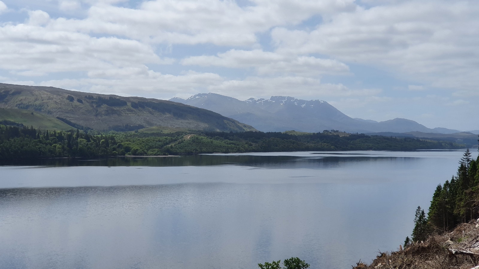
Gorgeous weather! Left Spean Bridge 8.30am Monday morning and had a relatively huge day's walk along a short bit of East Highland Way then through the Lairig Leacach to Loch Treig, under west-highland-railway-line, around Loch Corrour, met my ex-boss and family on their walk to Corrour!
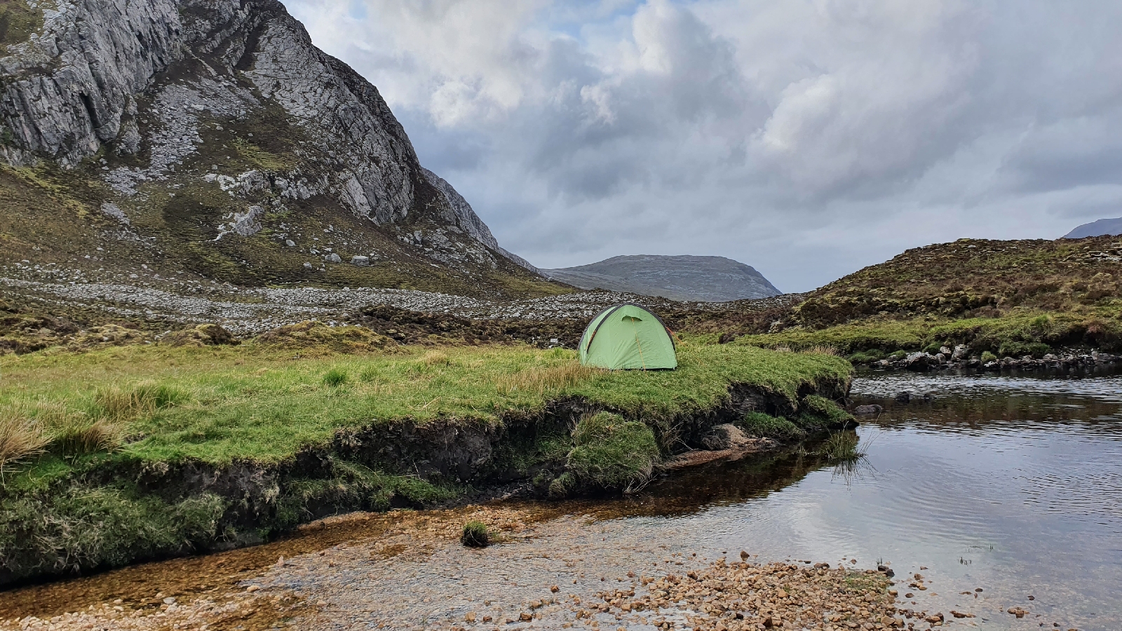
Nearly camped high at the ruin of Corrour Old Lodge, huge views, but after eating dinner early (midgie-avoidance) I chose to head on nice and relaxed for a few miles to slightly lower altitude, camping by a river, watching sunset (after which midgies started attacking). Then woken by the most bizarre noise. Like a cross between an angry cat and a whiplash. With some wierd rythmic coo-ing going on. 4.30am enough was enough and crept out tent to see what it was. Black Grouse with its tail fanned white. But lots of them - guessong this was a lek in progress. The aggressive sounds were males and the cooing was the female. Will have to fact check that!
Tuesday dawned gorgeous - no wind, but far too cold for midgies. Walked very relaxed down to Rannoch Station road and headed East to Bridge of Gaur, barely any traffic. Left road at Bridge of Gaur to head South, aiming fairly directly for home but with a hefty 750m pass of wild-walking to do to get into Upper Glen Lyon (not an easy glen to reach!).
Found a barely-used (and not maintained) track through lovely mixed woodland up the Eastern flanks of Gharbh Mheall and Meall Bhudhie (which was Finn's first Munro). Leggy-heather bashing but the hard work was paid for by the lush dell with oak and Scots pine.
Was overlooking Glen Lyon by 12pm, and descending into it the temperature became fairly unscottish, the smell of hot pine trees reminding me of holidays in the med! Road walked down to Moar farm where I could cross river, trying to dodge lambs and ewes whilst ascending diagonally towards Meall Ghordie and the pass on its Eastern side.
When I got there I felt very relaxed and satisfied with the journey and the fact I was kind of in familiar "home territory". Camped above Glen Lochay Tuesday night, high again to avoid bracken.
Then today was simply a case of walking down to Glen Lochay, Killin, then home, where I arrived by noon.
Great start to the epic walk, each additional day is a bonus...
Left Cluanie Inn before 8.30am after a simple breakfast (avoided the hot buffet stuff) and strong coffee. Cold, strong wind blowing in rain from the West, but intermittent so no bad. Headed S over edge of South Shiel Ridge down and across R. Loyne, then another pass over to Glen Garry. Bleak. Least fave day so far but at least the bit after South Shiel Ridge was all new for me. Road walking then tough going swampy stuff for more miles than I'd have liked, but only to end up spending hours on forest track. First proper struggle of the trip but eventually got to White Bridge near Invergarry and (slowly) ascended to Faichemard Farm campsite and what a gem of a place to arrive.
Huge showers and facilities.
Woken up 5.30am by caravan/car & slidy campervan doors, so gave in, packed up, midges were terrible whilst packing tent, headnet invaluable. Walked down Great Glen Way (once I got to it), pretty boring at first but got better and better as views opened up.
Arrived at Spean Bridge and went straight to Old Station Restaurant for a couple pints of Snowgoose and a veggie lasagne.
First niggles noted - right foot sore from all the hard surface and IT band aching too so ibuprofen for first time tonight.
Sorry for lack of pics, just using this blog to post progress updates for those interested (or worried!). After walking to Strathcarron on Wednesday with fine views of the Torridon Mountains from high up the Southern side of the glen, and via Bealach Ban, Thursday was another settled day weather and mind wise! Walked East to Loch Calavie then South past Maol Bhuidhe bothy to Glen Elchaig, then at Carnach turned South up a steep trail by a fab waterfall (not the falls of glomach but further east), kept walking into early evening until I found a campspot. Fairly high up at 400m but the wind disappeared and still no midgies! One of the most peaceful nights so far. That long day meant a short/moderate 14miles down to Glen Affric then South over a gentle but swampy pass to Cluanie Inn where I'm staying tonight (if they let me 😆).
Set off Monday (yesterday) from where I left of at Inverlael, over Dundonnel Peninsula to Corrie Hallie by An Teallach (no i wasn't "bagging" that, did that with four mates and a hangover about 25 years ago), missed the path to Shenavall Bothy but got there eventually via the Strath, then new territory for me again heading SW around Beinn Dearg along an awesome stalkers' path over to Carnmore Cottage where I camped with. a nice view over Dubh Loch. Woken up 3am by snipes drunming their wings near the tent.
Head photo in last proper blog post before CW-LE shows exactly where I was.
Today walked South over pass to Letterewe then what felt like a very long walk down Loch maree (was pretty, but I was tired) then on to Kinlochewe, arriving 2.30pm, buying a pile of junk food from shop, pitching tent at campsite, shower then hotel for local ales ( 3 course meal) all good.
Tomorrow heading to Strathcarron, hopefully can pitch-up there. Plan to start heading a bit more East from there...
Finally started the walk Sunday 14th May, chilly and damp start walking from Durness campsite down to ferry then shoogly bus to Cape Wrath to start proper. Weather improved as day went on, camped at Sandwood bay after a short day (breaking in gently!)
Next morning headed inland away from main Cape Wrath Trail routes, pathless but lovely, then easy track into Strath Dionard, enjoying sunny views of Fionaven from below where I met first other walkers encountered today. Camped W of Loch Dionard
nice and calm when I pitched but wind became wild, had to rotate tent in-situ, rough night, repegging guy ropes at midnight. Lesson learned.
Tuesday was perfect. Up over shoulder of Fionaven and by arkle on a pass toward Achfary
Weather forecast for Weds looked stormy, so took advantage of good weather and headed a few mile further than planned to Glencoul. Next section has very little shelter and wind and rain due to arrive afternoon.
Next morning was packed and walking by 6.15am, crossing probably the roughest ground of entire trip east of Ben More Assynt, but glad I went this way as I'd already walked the other option 2 years ago with Finn.
Got down to lower ground and found idyllic campspot in a meadow in trees, wind sounded like jet engine but was dead calm around tent. Other C.W.T. walkers arrived to camp in shelter, not surprisingly given they faced same situation!
Next day opportunity for first proper cooked meal in 6 days, at Oykel Bridge Hotel, 10 miles away. Got there before 1 pm and Lunch menu only but soup and sandwich easily beats dehydrated food.
Weather forecast looking good for tomorrow so going to head up Seanna Bhraigh en-route to Inverael.
And so today crossed Seanna Bhraigh, first "new Munro" for me in years! Awesome corrie below (no photo - battery limit after 6 days). Arrived at Inverlael 12.30pm, got lift from dad, and now going to enjoy a couple days rest and indulgence
Test post - ressurecting this blog for those that are interested in following progress of an attempt to backpack (mostly self-sufficient) from Cape Wrath to Land's End... Thanks! And maybe see some of you on the trail 😀
Distance: 30 miles (49km) Ascent/Descent: 2430m/2480m Start/Finish: Corrie Hallie (Dundonnel) - Poolewe Terrain: 50% good trail, 50% mountain Transport: WesterbusPoolewe - Dundonnel in morning Route: Route + GPX
Forget the summits - the stalkers' paths thread a fantastic route through this epic landscape and provide a point-to-point trail run that can be extended as and where you want. Of course I apparently can't forget the summits, not this time anyway, maybe next time, I'd like to think I'll be back in this area perhaps doing the Cape Wrath Trail or on some other self-inflicted adventure.
Blog
Yes it's been a while. Been doing plenty of exploring, hiking, camping and running, just got out the habit of posting about it. This particular journey was too nice not to share though. I have a video version of the report below if you don't get motion-sickness!
There's a bus service from Gairloch/Poolewe at 7:50am that passes Coire Hallie en-route to Ullapool. The right of way sign at the roadside indicates 18 miles to Poolewe, so the bus would be fine for this. However, for a journey of 30miles that included the Fisherfield summits, the bus would get me to the start far too late. Thankfully my dad was happy to drive my car back to Poolewe and do his walk down to the shore of Loch Maree from there, so I could start a wee bit earlier.
So around 7:15am I was following the stoney track towards the moorland beside An Teallach as I had last done many years ago as a student with a group of mates and a hangover! The car had indicated 2degC but once out of the shadow of the hillsides it felt much warmer and I had to remove the merino top. It would get much warmer - Shorts and T shirt throughout from here on! The track wound ahead into a wild scene of snow-speckled mountains, a very inspiring start to the day and already I was buzzing with anticipation. After passing the only 2 others I'd see in the area that day, I took a moment to take in the view over Shenavall Bothy set beneath the S slopes of An Teallach, surprisingly snow-free.
I had to drop down to and cross the river beneath me, then it would be mostly trackless cross-country and mountainside for the next 12 miles.
After pulling myself up onto the heather on the far side of the river, the onward route was upwards, finding a route up onto the shoulder of Beinn a' Chlaidheimh. The going was pretty rough at first, just picking my way through leggy heather, more and more exposed rock to help progress as height was gained. It was already rather warm - the temperature probably not even in double figures but with the sun's rays and lack of a breeze it was feeling quite exotic! A lizard, basking in the Spring sunshine, darted under a rock as I clumbsily approached. As my mouth was already dry, I took a diversion to a cascade and enjoyed gulping the fresh cool water, taking a short break to enjoy the situation and pick my route up the line of outcrops above. I basically ended up following a fairly direct line up onto the N shoulder of the ex-Munro (now a Corbett?), it wasn't as steep as it looked from head-on but still I wasn't running anymore, and
making use of all limbs! Snow appeared between the slabs, and once above them the angle eased and a stony/snowy climb lead to the narrow summit, which was an incredible place to be on this fine day, the views of An Teallach, and out to sea, were special.
I hadn't seen anyone since the couple heading for a traverse of An Teallach, and I wouldn't see anyone
until nearly arriving into Poolewe that evening. Not even fresh prints in the snow.
I was still unsure what the conditions would be like along the ridge, and if I'd encounter hard packed ice which I certainly wasn't equipped for and would have to retreat. I was glad to be heading mostly S so that I was descending on the less Wintery side of the mountains!
The next hill was Sgurr Ban, which looked intimidating until I realised I wasn't going to be heading directly up its N ridge, and instead arcing around a nice lochan onto a much easier-angled slope of boulders from the E.
Sgurr Ban whilst descending Beinn a' Chlaidheimh
Still my progress was relatively slow, not just because of the constant transition from snow to rock, but also because the views around were too distracting! The top of Sgurr Ban is quite a large bouldery place. From the top I could see the route ahead up Mullach Coire Mhic Fearchair and once again I felt intimidated! Any path that may have existed was buried, so I just picked the line with the most exposed rocks and went for it, taking care rather than rushing.
The final section felt quite alpine with its rocky summit falling sharply down above snow in front of a backdrop of glaciated Torridonian peaks! The part I was most worried about was a narrow path on the NW side of Meall Garbh. I had the trekking poles at least to test the snow in front. There was only one short bit where the steepness is such that the "path" felt a little exposed above a steep bank of snow.
I was glad to get safely onto the W side of Meall Garbh, and have another micro-break, looking across Lochan Fada to Slioch. A fairly easy (and less snowy) climb got me on top of Beinn Tarsuinn, the summit cairn guarded by a crow who promptly flew off to another cliff-edge as I approached. I felt a bit guilty about moving this crow along, I hope he came back to his spot once I'd moved along.
The ridge narrowed nicely, and eventually I reached a cairn marking the start of a plunge down towards the bealach between Tarsuinn an A' Mhaighdean. This was loose in places, and also a long way down, nearly down to 500m. The peat hags weren't too bad and was soon finding a trace of a path up below a line of outcrops on the E slope of A 'Mhaighdean. I used to poles to march up here, even though the angle was easy I'd ditched running uphills hours ago - saving the running muscles for the last 14 miles back to civilisation.
The ridge on Ben Tarsuinn, with A' Mhaighdean
I wasn't getting sick of the views, now able to look across and appreciate the bouldery summits I'd already crested earlier, and then a very different view South of the Torridon mountains, and then yet another very different view W out over the Atlantic Ocean with Skye and the Hebrides - particularly the Clisham Range, visible above low mist.
Fionn Loch from A' Mhaighdean
Before reaching the final summit - Ruadh Stac Mor - which was probably as red as my face at this point in the day, I had to negotiate some snow banks and crags, done safely by dropping more E first before NE down to the slabby bealach. Ruadh Stac Mor's terraced S slope was mostly snow free thankfully, but it was still bloody steep and loose, following a feint route marked by a cairn (from the crest of the bealach) that takes a diagonal line sort of NE up between a gap in the the mountain's rocky defences. I was gasping a bit when I finally reached the top, and the view was worth the hype, but once more I wasn't hanging around, quite keen to get the dodgy descent off this lump behind me so I could relax a little and enjoy running again, and on trails!
Looking back up the corrie between Ruadh Stac Mor and A' Mhaighdean
It felt so good to get onto that stalkers track down from the bealach towards Carnmore. Running again, and loving it, such a great place to enjoy this. My hunch is that the journey on these trails between Poolewe and Corie Hallie would be equally as enjoyable/spectacular as the journey upon the summits, and one day I may just have to come back to do that instead! Sometimes the best views of mountains are from beneath, not above.
And what an area to spend the night too - it seemed almost rude to charge through this landscape on this perfect day without putting up a tent and spending an evening watching the sunset, then soaking up the solitude beneath the stars. (On the counter-side, the wine did go down well back in Gairloch later!)
Descending above Dubh Loch, the cliffs plunging down into the opposite shore looked like the front cover of a Norway cruise brochure! And once down to the loch shore side, the view back up to the summits was equally dramatic. The sun was getting low by the time I'd crossed the short causeway and heading W, slowly away from the loch, beneath the shadow of Meall Meinnidh, and other lofty peaks in front reminding me I still had a fair way to go before reaching the coast.
However, the path was excellent and the running felt easy compared to the up and down over boulders and snow earlier. Finally the path crested a low rise and the edge of the forest above Kernsary became visible - the track ahead disappearing into it via a gate and stile.
The change of scene was pretty at first, but the track got a bit boggy in a couple of places so I was glad to get it done. Once past Kernsary farmhouse, where signs make it clear walkers and climbers are welcome on the estate, the path is now firm gravel all the way down to the head of Loch Maree where the River Ewe starts its short and rapid journey to the ocean. It was along this final stretch of road through the woods where I saw the only other people that day (since An Teallach). The had set not long before I arrived at the car.