A runners perspective


I hope this blog is of use/interest to walkers, runners and cyclists living in or intending to visit Scotland. Most of my entries below are described as long-distance runs - just because that's currently what I enjoy doing...

Sunday, 21 July 2013

Heart of the Cairngorm

Distance: 30.3 miles (48.5km) 
Ascent/Descent: 2000m/2000m Start/Finish: Linn o Dee 
Terrain: 20% gravel road, 70% Good trails, 10% off-trail  
Transport: Linn o Dee (near braemar) buses from Aberdeen and also
some Summers (2013) there's a service from Blairgowrie/Aberfeldy
Route: Route Map


Summary
This is a real cracker!  It took me a while to settle on this particular route, but so glad I did.  Although it takes in four Munro's, there are easier routes for bagging these (and including more) summits, but I wanted to explore beneath as well as above, especially around Loch Etchachan and Loch Avon.  Oh and never have to look at any of the ski-world to the North!  I also wanted to start from Linn o Dee because Glen Derry is such a nice approach into the wild.  From Derry Lodge the route heads up the 100% runnable path to Derry Cairngorm, then boulder-hops to Loch Etchachan, does an out-n-back onto Beinn Mheadoin, drops to Loch Avon (which really does feel like the heart of the Cairngorms as it is often considered), before ascending steeply from there up to the plateau and Cairngorm Mountain.  From the cairn, drop SE to "the saddle" (I descended a little down Strath Nethy for water here), then up mostly easy slopes to Bynack More on nice terrain with open views.  Then after a steep descent through the heather its a mostly-downhill 10mile trail-run back to Glen Derry then Linn o Dee. 

Blog
Derry Lodge, where many leave their bicycles
I enjoyed the early morning drive up the A93, the glens were still clagged with mist but I broke through momentarily into pure blue sky and brightness on the Cairnwell Pass. The thermo in the car read 8degC at Braemar, it would be 20degC warmer by the time I got back there at 4pm. (Aviemore was the hottest place in Britain today with temps reaching 29.5, so a fine day to be 1000m up on the summits!) 


Easy trail up into the blue.  Smell those pines!
The car park at Linn o Dee was thick with midge, so no faffing just straight on with the pack and off through the misty Caley Pine forest onto gravel road for 3miles to Derry Lodge, already there were already a fair number of munro-baggers' bikes scattered around here.  My route was heading for Derry Cairngorm, so over the footbridge I went onto an excellent track through the heather and pines, quickly gaining height, soon enjoying fabulous sunshine. It was only 8:30am but already very warm above the clag, the visibility was superb, Lochnagar dominating the skyline to the E, Beinn 'a Ghlo to the SW, and once onto the ridge proper,  I could admire the mouth of the Lairig Ghru with Cairn Toul's eastern corrie looking like a missing tooth.  

View back over Braemar way, Lochnagar the highest bump on horizon
The air was scented with warm pine and heather. Ascending up to the bouldery summit of 'Derry is relatively gentle (surprisingly runnable) and the ridge broad, but the views down both sides are fine with the meandering river Derry in its lush glen below to the right, and the Cairngorm 'big boys' to the left.

From the summit I descended the bouldery slopes N  towards the 3-way-bealach above Loch Etchachan, eventually catching up with some other runners near the water - a father and his young son (about 12!?).

After a brief chat, filling the bottles from the outflow of Etchachan, I ran up to the summit of Beinn Mheadhoin wondering if I'd just met a future 'Killian Jornet'! Sat on the summit tor and munched cookies in the sun.  Killian and his dad weren't far behind - I met them again as I retraced my way back to the loch, then turned N to join the trail that drops down to Loch Avon and Shelter Stone. 
Loch Avon beaneath Beinn Mheadhoin 
The heat was really building, and having dropped beneath some vertical rock (Shelter Stone Crag) this was really beginning to feel and smell like the Alps.

Once around the N shore of Loch Avon I stopped to drink from Allt Coire Raibeirt, and eat the crisps and bread rolls that had been toasted by the sun, before proceeding on the the very steep ascent beside the "Allt", one big rocky step after the other so I don't care who you think you are there's definitely no running up here!

...Until that is quite suddenly the Corrie is reached and the path transforms into a ridiculously manicured ribbon of gravel.  They were still working on this and gave me a wave as I jogged past.  So it was time to join the crowds at the Cairngorm mountain I thought, with its road, train and ski slopes.
Looking back  across the now-hidden Loch Avon to where I'd been - Derry Cairngorm just visible

View SW over Coire an Lochan towards Braeriach et al
Surprisingly there was only one couple sat at the summit cairn, but I didn't hang around anyway, heading off-trail now, E to eventually pick up a trail that would take me down between crags into Strath Nethy.  Getting thirsty again, so I dropped from the watershed to where the River Nethy is born so I could refill my bottles from it, then retraced onto a gradually disappearing trail NE up the shoulder of A' Choinneach, the highlight of this being the views back over Loch Avon again - truly worthy of the label "heart of the Cairngorm".  Legs getting tired so I was glad this was the last climb for me today,  finishing on the summit of Bynack More with its rock "barns".  Even with dead legs and thoughts dominated by pints of Guinness, these are interesting.  Freaky.  Two sets of them, the little brown barns on the crest, and the much bigger and totally differently grey ones down the slope a bit. 

The photos don't really portray the size - i.e. the little ones on the left are only about 6m high, whereas the big grey ones are about 20m.

Fords of Avon Refuge (MBA-maintained)
I had another sun-toasted roll with crisps at the summit then headed off-trail steeply through the thickening heather aiming for the main Glenmore-Braemar through-route known as the Lairig an Laoigh*.  It was really nice (and important) to get back down to water as the temperature continued to rise into the afternoon.  There wasn't much climbing left in the legs but they felt great again heading down to Glen Derry - probably because I'd stopped, eaten and drank so much.  There were a few more people down the glen - all with huge grins on their faces knowing they were bloody lucky to be where they were on such a fine day.


* My dad had done this a few days ago with an 80litre pack and a 72 year-old sense of adventure (a-walk-in-cairngorms). He was going to wait till the weekend when I could be around (safety-in-numbers) but the weather window earlier in the week looked too good to miss and there were no guarantees it would hold.

Wednesday, 3 April 2013

Killilan Loop

Distance: 34.3 miles (55km) 
Ascent/Descent: 1160m/1160m  
Start/Finish: Killilan, near Kyle of Lochalsh
Terrain: 80% gravel track, 15% feint grassy trails, 5% heather/bog 
Transport: train station at Attadale which gives good access to route.  I parked car at Killilan.
Route: Route Map


Summary
There's a vast area of wild country E of Loch Carron, NE of Loch Alsh/Loch Long, labelled Attadale and Killilan Forest on the OS mapOriginally I'd planned to backpack through it years ago.  The loop I've described here is relatively easy compared with most other routes in this blog, as there isn't much climbing and it keeps mostly to good tracks There is a short (1 mile) rough section of bog-hopping Nof Pait Lodge.  It is the remoteness that is of interest here - particularly felt when entering Coire nan Each N of Loch Mhoicean. The map link above shows the route in reverse - i.e., I actually did it anti-clockwise.  That way the last 10 miles were closer to civilisation, with a pussy-out option above Attadale Station.

Blog

The track through Glen Elchaig
The morning was grey and freezing.  That first five minutes after leaving the comfort of a warm car wasn't great, jogging a tad nervously in the direction of snow-speckled "nowhere".  Sure I'd left a crappy hand-drawn map of my planned route with my dad, and I was carrying plenty spare layers in the bag just in case, but it took me a good few miles of running up the estate road into Glen Elchaig before I began to chill-the-hell-out and enjoy what I was doing rather than worry about it.  I wouldn't meet a soul out there - not  until I got back to my car 7 hours later.  So if that's what you're after....

Looking towards Carnach along the shore of Loch na Leitreach
The first few miles were not so wild, but nice and easy going.  I remember lots of sheep and deer loitering by cylindrical feeders.  A few miles on and the surrounding hills close in and steepen a little, the place seems littered with rocks and the gorge of Glomach Falls comes into view to the South.  Loch na Leitreach gave me the creeps.  It was impossibly calm - not even a duck's fart.  It  reflected the hillsides so perfectly that I was only made aware of its existence when the I sensed something wrong about the movement of the landscape to my right.  It became a bit more obvious once around the corner where there was some sky bouncing of it.

The way continues easily up the glen, sneaking past Cannach and Iron Lodge, before the only significant climb of the day where the path loops upwards into the wild.  Back down at Iron Lodge an alternative route heads for nearby Loch Mullardoch - a loch surrounded by infamously remote Munros.  My onward journey was on their arguably more remote NW side, climbing up beside frozen waterfalls to the iced-over Loch Mhoicean.  I could feel the cold a lot more up here, there was now a breeze and it penetrated my gloves.

I don't think much happens around here - Coire nan Each
Beyond the loch and starting to descend, the obvious track onwards is the wrong one - a cairn on the right marks the true "path" down on the grassy side of lonely Coire nan Each.  Those tempted to continue by the easy obvious track will finish in the Heather of Doom (yet to be labelled on the map).

Its more like a piece of archaeology than a path to be honest, but its nice and bouncy, with leaps over bog and burn.  Towards the bottom it is more obvious, and where the glen narrows and the river is close, its continuation differs slightly from the map and so I missed my intended route (the one in the link above and marked on the map) which contours around the Corbett of An Cruachan, instead ending up with a harmless 0.5mile detour down to the bottom - a flat area of peat bogs, heather and lochans (Heather of Doom 2), but saved by another old path linking Maol Bhuide Bothy (interesting link) to Pait Lodge.


Allt Coire nan Each
The track to Pait Lodge improves significantly (title photo) and soon I was dropping easily down to the gate beside the lodge snuggled up beneath a conifer plantation.  Stretched before me was Loch Monar, the head water of Strathfarrar - indeed I had descended onto the Eastern watershed of Scotland.

Loch Monar and Pait Lodge from the Heather of Doom III
From Pait Lodge, its over the bridge into Heather of Doom 3 - a mile of traversing slightly upwards and Westwards, negotiating peat hags always by means of the higher and drier rockier ridges. There's a path marked on the map, but the map is a liar.  I contoured where possible so I could tackle this at a run and get it over with, but taking a good long breather higher up to soak in the surroundings of course!  The terrain remains pathless for another mile or so but it gets easier (the GPX route in the link above does lead directly to the excellent Landy track I was heading for).
Snowy An Riabhachan (L) and Sgurr na Lapaich (R) above An Gead Loch, seen from the NW
An Socach (L) dwarfing the very remote Corbetts An Cruachan (M), and Aonach Buidhe (R)
(I'd descended between the Corbetts earlier, heading "left" above those lochans)

Once onto the landy track, the going gets easy again, contouring back to the Scottish Watershed at Loch Calavie, where for the first time today I was on familiar territory (I'd run from Strathcarron to here back in 2010 whilst bagging the "Loch Monar Munros").  Like my hands earlier, the loch was partly frozen.  The track descends past Bendronaig Lodge (another Bothy), does a loop to take in a solid bridge and then its time to start working those tired legs again - a modest climb of 150m on a good track to attain another watershed and feel re-united with civilisation on the other side!  The big Attadale plantation forest comes into view, and the long town of Strathcarron is visible.

 I'm sure a few mountain-biking Munro baggers have haired down these hair-pins over the years. It was actually quite sunny by the time I got here, and for the first time today I felt quite warm.  And very thirsty.  Just a few miles left, and mostly easy ones at that.  After descending to the forest, a fingerpost (civilisation like I said) marks my onward route "left" back to Killilan, "7km" I think it said.


Looking back N from the Killilan-Attadale path
Looking over the River Ling with Faochaig (Corbett) above
The route is fairly easy to follow, descending down to the river, until the path seems to lose itself in some ruined shielings (it goes above them and drops down to the river confluence before swinging almost back on itself to gain a footbridge).

From here it was less than 3 miles back to the sun-heated car, and I was so glad to get there and down some water and junk food, feeling very satisfied with my day.

Sunday, 3 February 2013

St. Cuthbert's Way: Kirk Yetholm - Lindisfarne

Distance: 30.4 miles (49km)  
Ascent/Descent: 1040m/1140m  
Start/Finish: Kirk Yetholm To Lindisfarne  
Terrain: Grassy/boggy hill paths then farm tracks & quiet roads
Transport: Munro's buses serves Kirk Yetholm. Berwick-upon-Tweed is stop on main East coast train line, with shuttle buses to Lindisfarne (Mon - Sat)
Route: Route Map

St. Cuthbert's Way Stages: Prev [1] 2


Summary
The "other" half of the St. Cuthbert's Way starts in the Cheviot Hills, leaving them behind at Wooler and crossing moors and flood-plains to St. Cuthbert's cave, eventually dropping via woodland and fields to the North Sea and onto the Holy Island (either using the pilgrim's path direct over the sand, or the causeway, depending on tide and will).

Blog
A rare, exotic blog post since most of the second half of St. Cuthbert's Way is abroad in England.  Just two and a half hours of jogging over the Cheviots since breakfast, and I was hearing Geordie.  Fantastic!

We'd enjoyed a good evening at the Border Hotel - nice food, seem to be the place to go around here.  Waking up this morning, the wind was battering the window of the B&B and a peek through the curtains revealed an ominous low cloud-base and general darkness across the valley.  My dad & I ate our breakfast leisurely, and the hostess did much to help us plan our day ahead, even coming through with her laptop and printing off maps.  She'd had a group of guests the week before who'd just finished "the Spine" footrace - i.e. the 268mile length of the Pennine Way.  I'm glad there are nutters like that in the world.

Start/End of Pennine Way, Border Hotel behind
There was loads of breakfast and I stuffed most of it down, you'd think I'd settled for sitting in front of the telly all day.  Turns out it was very mild outside, the strong wind would be mostly side-on, slightly behind, the sun would even make a mid-day appearance and the hat and gloves would come off.  That was all fine but I was a bit disappointed that all the snow had been washed away, and I dreaded to think how muddy it was going to be after the thaw...  I worried too much - it was all going to be fine, other than the lingering fatigue from yesterday as to be expected, and that feeling of slow progress like yesterday.  It's all relative.

The plan was to meet back up with ground control a.k.a. dad at Wooler, 13 miles from Kirk Yetholm across the border, have a coffee there, then later in the afternoon try and meet up again somewhere around St. Cuthbert's Cave given there was a car-park and walks in the area for my dad.  The tide timetables for the Holy Island causeway looked favourable, it would more likely be daylight that would force a schedule here.

Goodbye to the Pennine Way
There are very few of those National Trail "acorn" signposts in Scotland (we use the thistle up here), but the few of them you'll find are on the stretch of Pennine Way between Kirk Yetholm and the English border.  St. Cuthbert's Way joins the Pennine Way for a couple of miles into the Cheviot hills, steep tarmac at first, then onto a good trail up the grassy contours of Green Humbleton.  No doubt like everyone else who walks/runs/whatevers the St. Cuthbert's Way, I spent a moment's contemplation at the final "acorn" signpost where St. Cuthbert's pilgrims are routed away from the pedestrian equivalent of the M6 to Manchester.  Its actually part of "E2" now I think, prochane arrêt, Nice. I'd never thought of the Cheviot Hills as being so cosmopolitan.

Within minutes of leaving the Pennine Way behind, I was at border control - which currently comprises a stone wall on the crest of a ridge, but plenty ancient hill forts around to remind us how rare a moment in history this is to have such laxity!  From the border it was downhill towards a forest -  that's where you're supposed to go if following the official way, I missed the sign obviously, and accidentally tresspassed along sheep paths to the N side of the Elsdon Burn (a burn, in England?).  Realising my mistake I was able to rejoin the correct route after the trees.

Descending to the Elsdon Burn - you're supposed to go through  the trees
The route follows a good farmtrack down to a farm, which I guess makes sense, then its tarmac road for a bit, but more like the farmer's driveway than a road, very peaceful and a nice valley setting.  This is followed down to the hamlet of Hethpool and the valley of the College Burn.  Now here's an area well worth further exploration, it looks like a great approach to climbing the 815m Cheviot - I guess you could come back via the Pennine Way as well.  I think this whole area warrants further exploration, and with a bicycle too, lots of empty roads in nice countryside.

Following Elsdon Burn down to Hethpool
The St. Cuthbert's Way guide (and OS map) indicate there are medieval cultivated terraces down here on the left, but the impromptu nature of this weekend meant I hadn't had time to read-up and so went ignorantly by, past Hethpool and into forest with feral goats watching me through the trees.  It was very wet underfoot along this bit, not much of a path to follow, but it was a nice situation anyway.
Newton Tors, Nothumberland

After threatening to follow a road down off the hills St. Cuthbert's Way suddenly veers right, quite steeply up grassy hillside, eventually onto heather moors behind 361m Yeavering Bell (with its necklace of stones, being another ex-hill-fort).  The expanse and relative flatness of this high area reminded me a bit of the North Yorks Moors, although the snowy bulk of the Cheviot gave things away a bit.

"Burn" after the goats and marshy bit
Its a really nice enjoyable and varied descent from here to Wooler, first back onto grassy rolling hillside, then into forest down to a pretty picnic area with forest walks (sort of place you might take mother for a Sunday drive!?) then back up into more forest before dropping quite steeply down into Wooler.  My dad was at the top of town, having recce-ed for a cafe.  Coffee and scone was had in the seats nearest the door given the amount of mud caked to our hiking trousers.  "Dinnat worry about it," she re-assured us, but still...


300m up on Black Law, Cheviot in background, not far from Wooler...
 During the coffee we discussed where to meet next, and agreed we'd stick to the idea of meeting up around St. Cuthbert's Cave.

Before Wooler, looking W back towards Yeavering Bell
The sun was out and it was warm as I headed down the road, across the busy A697 and a bridge over Wooler Water, where the route heads S through a housing estate before getting back on course for the coast once more, E along a quiet lane towards Weetwood Moor.  It was steep uphill, I'd just had a scone, so I was reduced to a walk.  The hat and gloves were off - so different from yesterday at this moment.  The way leaves the road behind to continue the ascent up onto the moor - up a gouged-out bit of hillside which was quite rough after the road, it was like a natural gutter for the hillside!  Washed-up bits of vegetation and lots of sand deposits.  Was nice to get over a style and out onto open moor, with views around.

The way drops steeply N off Weetwood moor through a bracken-filled nursery of trees, the bracken dead and brown just now but could be interesting in mid-Summer I'd imagine.  From up here there was a great view of the impressive Weetwood Bridge.

Looking N to Weetwood bridge from the edge of Weetwood Moor

A long stretch of road and farm-track followed, the Cheviots were left behind now but it certainly wasn't flat country, up, down, up, down, zig-zagging towards St. Cuthbert's Cave.  The way resorted to fields, some well-and-truly "divotted" by cows, and it was back to mud and a slow pace heading towards the forested hillside of "Cockenheugh" which hosts St. Cuthbert's Cave, and at this moment in time, my dad.  We met up along the nice track through the trees heading NNW.  My dad was as aware as I was of the race-against-daylight that was going on here, and started jogging along too.  Pity I didn't really give the caves a proper visit, but at least my dad got to.

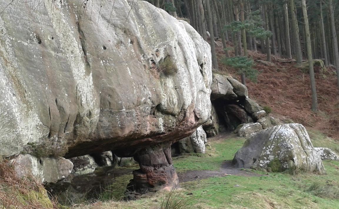
St. Cuthbert's Cave
Back uphill over the last ridge before the North Sea, heather, then grass, with sheep joining in.  My dad had just made the same observation I had a few years ago regarding sheep South of the border..  He asked if I'd noticed how the sheep are different in England, that they don't just get out of the way, and some even run after you?  But in Scotland, sheep always run away?  Hmm, no further questions your honour.

From the high area of Holburn Moss (well that's what its called on the map) I was now looking over the coast, and in spite of the cloud coming back in, Holy Island was clearly visible below.  Although the way did make a V-turn away from it to take in Shiellow Wood.  The route through the trees was nice, although missing a critical sign at one point where a narrow trail cuts away from the forest road where it approaches a house - I guessed my way onto that trail and followed the muddy route down and out of the trees and back onto field-edges, eventually onto a road downhill into the village of Fenwick (no services) where my dad was parked and waiting.  Just over 5 miles to go, most of those on the causeway/island, plenty daylight left, all good!

Changed into shorts and ditched the bag and trail shoes so I could pick the pace up a few gears.  Felt brilliant to bound over the A1 and along the tarmac beyond which I naively hoped would take me all the way to Lindisfarne.  Instead a fingerpost sent me up a mud-ramp which was hard enough standing still on never mind moving forwards), then across a pond (i.e., presently flooded field), then down the side of ploughed fields to cross the East Coast Mainline (very busy - two trains went speeding by in opposite directions as I approached).  The causeway was very close from here.
My dad gives me a head-start onto the causeway.  3.5miles to go...
My dad was parked before the causeway, and it looked clear of water - the notice said we had until 17:45 to get back across.  Game on!

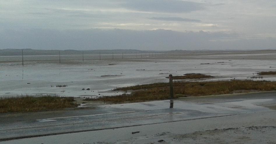
Looking from Holy Is.  The posts across the sand are the "Pilgrims Path"
Even from the causeway, I could just make out the snowy Cheviot Hill about 30 miles inland over my shoulder.  We got into town just before the cafe was closing, so just enough time for a celebratory coffee.  Wandering around very briefly, maybe too briefly, we wanted to get back across that sand-dusted and unlit causeway before it got dark!  It had been another great weekend, and a nice change from doing jobs around the house.

Lindisfarne Priory (Castle behind)

St. Cuthbert's Way Stages: Prev [1] 2

Saturday, 2 February 2013

St. Cuthberts Way: Melrose - Kirk Yetholm

Distance: 32 miles (51.5km)  
Ascent/Descent: 1170m/1140m (less 100m & 1mile if you omit Eildon "Mid Hill")  
Start/Finish: Melrose to Kirk Yetholm  
Terrain: Muddy trails, some (very quiet) roads
Transport: First buses, and Munro's buses. Berwick-upon-Tweed is stop on main East coast train line, with shuttle buses to Lindisfarne (Mon - Sat)
Route: Route Map

St. Cuthbert's Way Stages: 1 [2] Next

Summary
Although a low-level route, its fair to say I underestimated the terrain underfoot - and dragging a bike along would be a pain in the @rse, for me at least.  I also underestimated how nice it is, expecting to be spending most of the journey trudging along the rough edges of samey fields. As well as fields there are great rivers, dells, pretty villages, woodlands, moorlands, abbeys, churches, monuments, castles, forts, country parks and country pubs with fire places...

Blog
Melrose Abbey
The idea to spend this weekend exporing the St. Cuthbert's Way occurred just Friday morning, when I discovered the "Met. Office" had filled the map of scotland with sun symbols for all of Saturday.  Well I couldn't let this historic event pass - especially as it had been a wee while since I last headed to the trails.  For the right reasons really, with lot's of stuff needing done (like moving home for example!), but at last I was going to get back to the real world.

Although the decision had been spontaneous I had looked into this route a few months ago, planning to split the run at Kirk Yetholm thus fitting it nicely into two of Winter's short days.  There's a bus to Melrose Saturday morning from Edinburgh, and a train home from Berwick-upon-tweed not too far from the finish at Lindisfarne, but I was gratefully saved from working around public transport when my dad phoned up about something completely unrelated, I told him my intentions, and later he got back to me saying he was "allowed to go".

Looking W from the 422m top of Eildon Mid Hill (a bonus option!)
Saturday morning was stunning as promised.  The car indicated 0-degC outside, and patches of slushy ice lined the sides of the A68.  It wasn't expected to get much warmer than that today so I hoped the freezing temperature would keep all the trails nice and firm.  (Nope).

I parked in the tidy centre of Melrose, from where we walked the short distance to the abbey and  found a nearby cafe in which to take refuge from a bitterly cold breeze.  That breeze would be my tailwind for the day.


The way ahead (snowy Cheviots on horizon)
My dad drove off to Kirk Yetholm, planting my "drop bag" en-route at a lay-by where the St. Cuthberts Way crosses the main road to Kelso.  Then he'd be free to do his walk up in the Cheviots - an area neither of us had explored.  Meanwhile I was jogging up Dingleton Road in search of my first St. Cuthbert's Way marker/sign.  It directed me to run through the wall of someone's house.  A bit further on and there were steps heading down then up through trees and onto the steep slopes of the Eildon Hills, then fences were guiding me up between fields and into gorse and heather, running on semi-frozen mud which was a bit greasy but no dramas.  Apart from that first sign, this was a great start to a long distance path - straight up onto hills renowned for their extensive views.  I was soon upon the saddle of the hills looking over the St. Cuthbert's countryside, with the snow-caked Cheviots - my eventual destination today - looking very, very far away!  In spite of this I couldn't resist taking a detour and climbing to the top of nearby Mid Hill, well worth the extra effort.

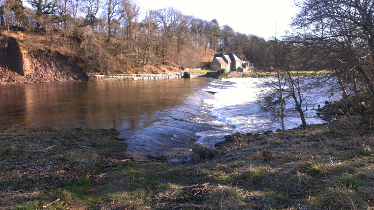
Following Bowden Burn towards the R. Tweed
Returning to the saddle, I descended carefully down the ice-glazed hillside into some nice woodland, said hello to a couple of horses in a field, crossed a burn then back up through another wooded hillside before arriving at the very tidy village of Bowden.  Then down to the Bowden Burn, following a cute track along a dell, which wasn't so cute later on where it had been churned up by horses and I could barely walk never mind run.  That's why I was quite glad to reach tarmac road downhill to Newton St. Boswells, signs directing me on a zig-zag course amongst back-yards and eventually down to the Bowden Burn again, which was followed to its confluence with the Tweed.

 The next mile or so was along the banks of the majestic river.  I found the trail surprisingly hard going, lots of steps cutting up and down the wooded embankment, and between the steps was more of that greasy mud.  I probably should have expected this having heard the reports from runners of the inaugural "Three Peaks Ultra Marathon" back in October, which followed this part of the route.

A series of steps interspersed with mud along the banks of the River Tweed
Up another wooded dell into St. Bowswells (presumably the "Oldtown" version) then back down to the river to entertain golfers.  This next stretch reminded me so much of last year's "Thames Trot 50" race which happened to be taking place again today.  Memories of frosty, river-side scenes.
Maxton Church (dedicated to St. Cuthbert)
I left the Tweed at Maxton Church (dedicated to St. Cuthbert) and shortly after began the long boggy and very linear tramp up "Dere Street".  With roads like this its no wonder the romans never got past the Firth of Forth.  Too stubborn to "go around" hills or obstacles.

Excusing the pun, the St.Cuthberts Way religiously follows the roman road for at least 6 miles. After 4 of them I was begging for a corner, but there was stuff to keep me amused.  On the hill to my left was a concrete tardis.  A bit further on, another hill had   a concrete phallus Waterloo Monument.  And after more mud, gorse, and iced-over puddles I came to "Lilliard's Stone". 

Lilliard's Stone, with Dere Street going on, and on, and on..
The way eventually crosses a road and enters a dense plantation, dipping into another nice dell on its way South into Harestanes Country Park.  The mud-strip circumnavigates this before arriving at another great borders river - the Teviot.  Now there are plenty signposts for this walk but you can't rely on them alone - when the mud track reaches the river, follow the mud to the right, which leads you through the trees towards a left turn for a fine suspension bridge which takes you to the mud on the other side.  To be fair this next bit wasn't bad, grassy for at least half a mile as the route doubles back on itself along the river's southern bank before turning South to find the Kelso road, and my cue to find the drop-bag my dad had planted at a lay-by.

Sitting on the old railway platform here, munching on a banana, I contemplated how slow I was moving today, with only 17miles done and 14 to go. Sure this wasn't a race or time trial, nor was there any particular need to rush, it just felt like more effort to move forward than almost all other, much hillier routes I've done.  Couldn't blame the (tail) wind, so was it the amount of under-foot grease?  Or inside-belly grease!?  It hadn't been long since Christmas, but I can't put all the blame on Terry's chocolate orange.

"Please shut the gate".  Footbridge over Oxnam Water beyond
 The way continued South, roman style, leaving Dere Street after a mile uphill where a fingerpost sent me NE down a shelter-belt and out onto tarmac.  It was a brief stint up a hedge-lined road before being routed off into woodland then down to a bridge over Oxnam Water.


Cessford Castle and remaining bit of wall
Sitting having a breather on the grassy hill above the burn, I noted that those distinct Eildon Hills, which seemed to have been stalking me since Bowden, were finally dropping away into the distance.  Very soon I was about to get another indication of my progress towards the white Chieviots - little speckles of snow where the sun hadn't hit the steep tarmac hill to the South of Oxnam Water.  A I progressed East, there were more lingering sprinkles of white, first in the shadows of hedges along the road, then lots more up the sides of another wooded dell, and after that, a dusting along the side of a stone wall between fields as the way climbed.  When I crested this hill the Cheviots re-appeared and were suddenly very close.
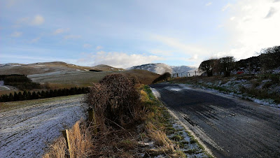
Road after Morebattle
I stood here to admire the view for a moment, looking from Cessford moor with Cessford castle below.  Perhaps the fastest four miles of the journey followed - farmtrack then tarmac, down to and around the castle, then beyond to the quaint village of Morebattle where the pavements were dusted white and the roads dipped into pools of slush.

I looked longingly at the Templehall Hotel thinking of warmth and a pint, but knew I'd enjoy it all the more once safely arrived at Kirk Yetholm, hopefully before dusk.

Overlooking the valley of Kale Water
Even though the final 7 miles between Morebattle and Kirk Yetholm involved proper hills (you know what I mean), I found this bit much easier going then the muddy riverside paths earlier, and the 6 miles of roman swamp.  The route up "Grubbit Law" - what a great name - starts with a footbridge over Kale Water, and so the road is left behind and its time to meet some cows.  I showed them the respect they deserve by walking not running through their field, and those blocking my path politely moved aside.

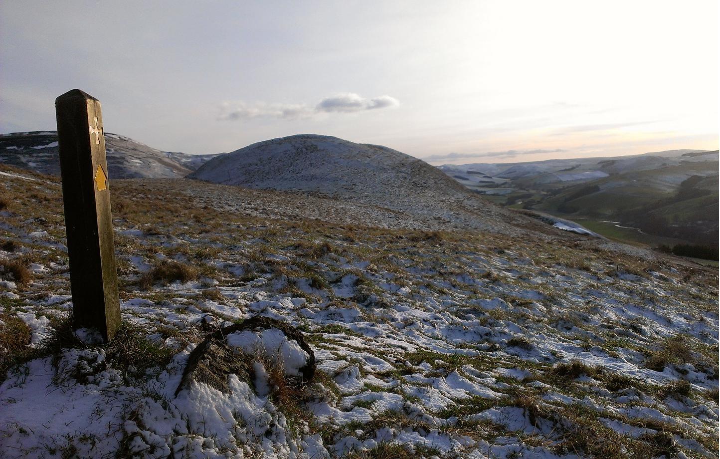
Waymarker on Wideopen Hill
From here it was up and over Wideopen Hill, where a happy group of walkers asked me to take their picture, and pointed out the sign indicated this was both half way and the highest point of the St. Cuthbert's Way (a mere 368m, how easy to underestimate this journey!).  From here it was a fun descent down the broad grassy ridge, following the line of the Cheviots NE, down into the glen that shelters the Yetholms.  I was glad to have arrived before sunset, and was glad to find my dad still in the bar with the rugby on.  Plastered in mud though I was, the shower could wait for a bit.

To be continued..

St. Cuthbert's Way Stages: 1 [2] Next